
OS grid reference ND222733 Sovereign state United Kingdom Postcode district KW14 Local time Saturday 7:02 PM | Post town THURSO Dialling code 01847 | |
 | ||
Weather 6°C, Wind E at 29 km/h, 88% Humidity UK parliament constituency | ||
Brough is a small village (population 66) in Caithness in the North of Scotland. It is located on the B855 single-track road, the most northerly numbered road on the mainland of Great Britain, and is a few miles to the south east of Dunnet Head, the most northerly point on the British mainland, and a mile or so north of the village of Dunnet. Brough is the site of Brough Castle, a 12th Century Norse fortress; the ruins are on the property now known as Heathcliff. Brough is the most northerly village on the British mainland.
Contents
Map of Brough, Thurso, UK
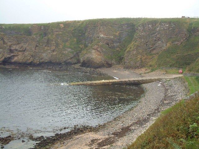
The village has a bus stop. Brough harbour, a short distance to the north of the village, now little used, faces Little Clett rock, a small islet that shelters the harbour from the north.
To the south of the village lies St John's Loch, reputedly a very good brown trout loch.
Name
The name Brough is pronounced to rhyme with the Scottish word loch, in contrast to the English town of Brough, which is pronounced to rhyme with rough
The village's name comes from Broch, the ancient Scottish circular building, whose purpose is somewhat undetermined but was probably some kind of fortified homestead. The remains of at least one broch exist in the area around the village.
Wildlife
The village, and the area, are popular particularly with birdspotters, providing opportunities to see many puffins (at Brough Harbour) and Great Northern Divers among others.