
Highest elevation 64 m (210 ft) | Area 2.8 km (1.1 sq mi) Highest point Durmålshaugen Municipality Hadsel | |
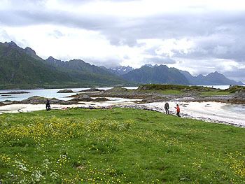 | ||
Brottøya is an island in Hadsel municipality in Nordland county, Norway. The island lies in Hadselfjord, on the west side of the northern entrance to Raftsundet. Brottøya has an area of approximately 2.8 km² and the highest point is Durmålshaugen at 64 m.
Map of Brott%C3%B8ya, 8414 Hennes, Norway
Brottøya has a speedboat connection to Stokmarknes and Kaljord. The island is also stopover for the car ferry between Kaljord and Hanøy.
During the planning of Lofoten's mainland connection (Lofast) there was an option to add the road over Brottøya to Helgenes and Lonkan and further toward Hennes, Blokken and Sigerfjorden. The alternative, however, was rejected, and Lofast was instead built against Gullesfjorden and by bridge over Raftsundet.
References
Brottøya Wikipedia(Text) CC BY-SA