
Country United States County Linn FIPS code 29-08650 Elevation 232 m Population 4,399 (2013) Area code 660 | Time zone Central (CST) (UTC-6) GNIS feature ID 0735530 Zip code 64628 Local time Saturday 12:41 AM | |
 | ||
Weather 3°C, Wind SE at 13 km/h, 54% Humidity Area 11.11 km² (11.06 km² Land / 5 ha Water) | ||
Brookfield is a city in Linn County, Missouri, United States. The population was 4,542 at the 2010 census.
Contents
- Map of Brookfield MO 64628 USA
- Kaitlan from brookfield missouri shares her 2010 hyundai santa fe buying story
- History
- Geography
- 2010 census
- 2000 census
- Attractions
- Newspapers
- Radio
- Notable people
- References
Map of Brookfield, MO 64628, USA
Kaitlan from brookfield missouri shares her 2010 hyundai santa fe buying story
History
Brookfield was surveyed in 1859 by John Wood Brooks, a native of Boston. John Wood Brooks is further remembered by the names of four Brookfield streets: John, Wood, Brooks, and Boston streets. A post office called Brookfield has been in operation since 1860.
Geography
Brookfield is located at 39°46′59″N 93°4′26″W (39.783155, -93.073871). According to the United States Census Bureau, the city has a total area of 4.29 square miles (11.11 km2), of which 4.27 square miles (11.06 km2) is land and 0.02 square miles (0.05 km2) is water.
2010 census
As of the census of 2010, there were 4,542 people, 1,892 households, and 1,146 families residing in the city. The population density was 1,063.7 inhabitants per square mile (410.7/km2). There were 2,280 housing units at an average density of 534.0 per square mile (206.2/km2). The racial makeup of the city was 95.4% White, 1.3% African American, 0.3% Native American, 0.3% Asian, 0.6% from other races, and 2.1% from two or more races. Hispanic or Latino of any race were 2.0% of the population.
There were 1,892 households of which 30.8% had children under the age of 18 living with them, 43.3% were married couples living together, 12.5% had a female householder with no husband present, 4.7% had a male householder with no wife present, and 39.4% were non-families. 34.5% of all households were made up of individuals and 16.4% had someone living alone who was 65 years of age or older. The average household size was 2.32 and the average family size was 2.96.
The median age in the city was 40.6 years. 25.8% of residents were under the age of 18; 7.1% were between the ages of 18 and 24; 21.6% were from 25 to 44; 25.1% were from 45 to 64; and 20.5% were 65 years of age or older. The gender makeup of the city was 45.9% male and 54.1% female.
2000 census
As of the census of 2000, there were 4,769 people, 2,058 households, and 1,234 families residing in the city. The population density was 1,110.2 people per square mile (428.2/km²). There were 2,394 housing units at an average density of 557.3/sq mi (215.0/km²). The racial makeup of the city was 96.94% White, 1.26% African American, 0.36% Native American, 0.15% Asian, 0.13% from other races, and 1.17% from two or more races. Hispanic or Latino of any race were 0.94% of the population.
There were 2,058 households out of which 27.2% had children under the age of 18 living with them, 44.8% were married couples living together, 11.4% had a female householder with no husband present, and 40.0% were non-families. 35.3% of all households were made up of individuals and 20.7% had someone living alone who was 65 years of age or older. The average household size was 2.23 and the average family size was 2.86.
In the city, the population was spread out with 24.1% under the age of 18, 7.2% from 18 to 24, 23.1% from 25 to 44, 20.8% from 45 to 64, and 24.9% who were 65 years of age or older. The median age was 42 years. For every 100 females there were 83.4 males. For every 100 females age 18 and over, there were 77.9 males.
The median income for a household in the city was $25,753, and the median income for a family was $32,385. Males had a median income of $23,284 versus $19,004 for females. The per capita income for the city was $14,842. About 14.7% of families and 19.1% of the population were below the poverty line, including 28.7% of those under age 18 and 14.8% of those age 65 or over.
Attractions
Every Labor Day weekend, Brookfield hosts the Great Pershing Balloon Derby.
Every fall the Brookfield Bulldogs play the Marceline Tigers in the annual Bell Game which is one of the oldest high school football rivalries in the United States. The Bell Game won a USA Today national contest for the nations best football rivalry in 2012. The Bell Game rivalry received 1,761,878 votes and won a $10,000 prize divided equally between Brookfield and Marceline.
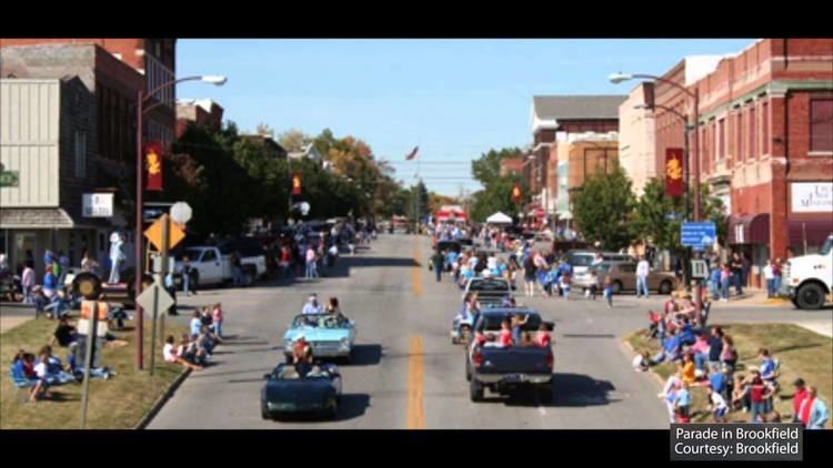
Every year Brookfield hosts Summer Fun Days, a festival that takes place in the uptown Main Street area. Summer Fun Days marks the start of summer for families in and around Brookfield, with activities including a parade, craft fair, baby contest, games, and other family events.