
Prominence ca. 20 m Listing none OS grid SE106027 | Parent peak Upper Heyden Elevation 523 m | |
 | ||
Location Derbyshire, England, UK | ||
Britland Edge Hill is a hill, 523 metres (1,716 ft) high, in the Peak District in the county of Derbyshire in England.
Description
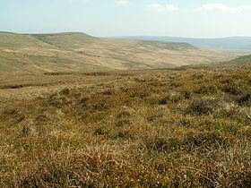
Britland Edge Hill is a prominent hill in the northern Peak District between the towns of Glossop and Holmfirth. It rises east of the A6024. To the south it descends to a prominent spur, known as Dewhill Naze, which in turn drops steeply into the valley of the Heyden Brook and Woodhead Reservoir. The hill, like most of the surrounding area is bare and open. There are no footpaths to the top, but there is a car park about 1.5 km to the north-northwest, where the A6024 crosses the adjoining ridge of Upper Heyden.
References
Britland Edge Hill Wikipedia(Text) CC BY-SA