
Country United States County Rockingham Time zone Eastern (UTC-5) Elevation 35 m Population 4,486 (2010) | Incorporated 1742 Area code(s) 603 Zip code 03833 Local time Thursday 11:40 PM | |
 | ||
Weather -2°C, Wind NW at 21 km/h, 29% Humidity | ||
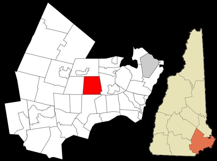
Brentwood is a town in Rockingham County, New Hampshire, United States. As of the 2010 census, the town had a total population of 4,486. Brentwood has been the county seat of Rockingham County since 1997. It is drained by the Piscassic, Little and Exeter rivers.
Contents
Map of Brentwood, NH 03833, USA
History
Long before Europeans settled the area, Brentwood was home to the Pennacook Abenaki tribes which farmed, fished and hunted there. Two main foot trails ran through the town, one along the Exeter River, where arrowheads and other stone and wooden artifacts have been found. At Pickpocket Dam, this pathway joined with the historic Pentucket Trail leading to Haverhill, Massachusetts, or points north.
The town was once a part of Exeter known as Brentwood Parish. It was named after Brentwood, Essex, originally called "Burnt Wood", where, in 1177, King Henry II granted permission for 40 acres (160,000 m2) of the king's forest to be cut, burned and cultivated. As early as 1738, residents living in the southwestern portion of Exeter, now Brentwood and Fremont, petitioned to be set off, but were denied. On 26 June 1742, however, permission was granted, and Brentwood was incorporated by Colonial Governor Benning Wentworth.
But almost from the beginning, a dispute arose between districts regarding the placement of a meetinghouse. It divided the community. Consequently, Gov. Wentworth, acting without approval of the General Assembly, in 1744 issued a King's Patent to establish a new town within Brentwood called Keeneborough Parish, named after his friend, Sir Benjamin Keene (1697–1757), English minister to Spain. Factions reconciled in 1750, when Keeneborough reunited with Brentwood.
Mills along the rivers produced lumber and manufactured goods in the early days, although the community would shift towards the cultivation of agriculture. It is now predominantly residential.
Brentwood was marginally involved in the Exeter incident, a UFO sighting in 1965. While the main incident was reported in nearby Kensington, a young Brentwood couple, Jack Sidoway and Lindsey Webb, also reported having seen lights while parked out in a field. They claimed that these lights followed them as they got out of their car and ran through a field in order to "try to get away from the lights." It is thought that their claims were not taken seriously due to their age. Also as this account is from Brentwood and not Exeter it was not included in the official Exeter documents, and as such were overlooked.
Geography
According to the United States Census Bureau, the town has a total area of 17.0 square miles (44.0 km2), of which 16.8 square miles (43.4 km2) is land and 0.23 square miles (0.6 km2) is water, comprising 1.30% of the town. The highest point in Brentwood is Great Hill, at 275 feet (84 m) above sea level, whose summit is in the southeast corner of the town. The town is drained by the Exeter River and its tributaries. Brentwood lies fully within the Piscataqua River (Coastal) watershed.
Demographics
As of the census of 2010, there were 4,486 people, 1,319 households, and 1,087 families residing in the town. The population density was 267.0 people per square mile (103.4/km²). There were 1,350 housing units at an average density of 80.4 per square mile (31.1/km²). The racial makeup of the town was 96.3% White, 0.7% African American, 0.1% Native American, 1.0% Asian, 0.1% Pacific Islander, 0.5% some other race, and 1.3% from two or more races. Hispanic or Latino of any race were 1.5% of the population.
There were 1,319 households, out of which 46.2% had children under the age of 18 living with them, 71.6% were headed by married couples living together, 7.1% had a female householder with no husband present, and 17.6% were non-families. 14.0% of all households were made up of individuals, and 5.9% were someone living alone who was 65 years of age or older. The average household size was 3.02, and the average family size was 3.33.
In the town, the population was spread out with 26.6% under the age of 18, 7.2% from 18 to 24, 24.0% from 25 to 44, 28.8% from 45 to 64, and 13.4% who were 65 years of age or older. The median age was 41.1 years. For every 100 females there were 106.1 males. For every 100 females age 18 and over, there were 106.6 males.
For the period 2007-2011, the estimated median annual income for a household in the town was $110,250, and the median income for a family was $111,650. Male full-time workers had a median income of $69,565 versus $55,000 for females. The per capita income for the town was $37,385. About 1.0% of families and 2.2% of the population were below the poverty line, including 3.2% of those under age 18 and 0.4% of those age 65 or over.