
Population 5,299 Civil parish Brayton Sovereign state United Kingdom Local time Thursday 8:50 PM | OS grid reference SE600305 | |
 | ||
Weather 4°C, Wind S at 11 km/h, 70% Humidity | ||
Brayton is a small village and civil parish in the Selby district of North Yorkshire, England. The village is situated approximately 1 mile (1.6 km) south from Selby.
Contents
Map of Brayton, UK
The United Kingdom Census 2001 states the population of Brayton to be 5,514, reducing to 5,299 at the 2011 Census.
Brayton is almost entirely residential with the exception of a few local shops, including a butchers and a post office.
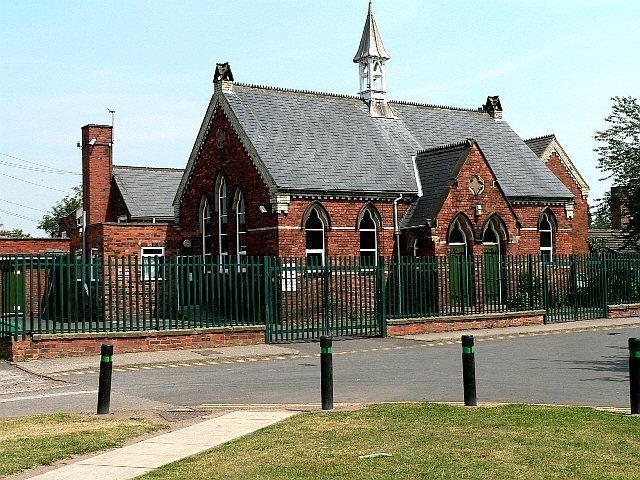
Village schools are Brayton Academy, Brayton Juniors, and Brayton C of E Infants. The Infant School is one of the oldest buildings in the village. The school house was once home to the headmistress of Brayton school, and lessons were taken in a smaller building. The house is now a private residence, and the old school room is now a small part of the extended building.
Wesley Chapel and St Wilfrid's church are the two religious buildings. Wesley Chapel was founded by Charles Wesley, father of composer Samuel Wesley. It is now a nursery school and still a place of worship. The Grade I listed Church of England parish church, dedicated to St Wilfrid, dates from the 12th to the 15th centuries with 19th-century alterations and stained glass. Within the church is a tomb to Lord D'Arcy (died 1558), and his wife, it's effigies damaged during the 17th-century Interregnum.
Governance
An electoral ward in the same name exists. This ward stretches to Barlow with a total population of 6,052.