
 | ||
Bradley land iraq
Bradley Land was the name Frederick Cook gave to a mass of land which he claimed to have seen between (84°20′N 102°0′W) and (85°11′N 102°0′W) during a 1909 expedition. He described it as two masses of land with a break, a strait, or an indentation between. The land was named for John R. Bradley, who had sponsored Cook's expedition.
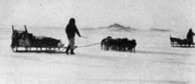
Cook published two photographs of the land and described it thus: "The lower coast resembled Heiberg Island, with mountains and high valleys. The upper coast I estimated as being about one thousand feet high, flat, and covered with a thin sheet ice."
It is now known there is no land at that location and Cook's observations were based on either a misidentification of sea ice or an outright fabrication. Cook's Inuit companions reported that the photographs were actually taken near the coast of Axel Heiberg Island.