
Population 7,699 (2011 census) Postal code 3128 | Postcode(s) 3128 Area 3.5 km² | |
 | ||
Location 14 km (9 mi) from Melbourne | ||
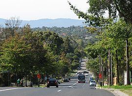
Box Hill South is a suburb of Melbourne, Victoria, Australia, 14 km east of Melbourne's Central Business District. Its local government area is the City of Whitehorse. At the 2011 Census, Box Hill South had a population of 7,699.
Contents
- Map of Box Hill South VIC 3128 Australia
- History
- Geography
- Education
- Sport and recreation
- Shopping
- Transport
- Industrial zone
- Places of worship
- Retirement village
- References
Map of Box Hill South VIC 3128, Australia
History
In the summer of 1885/86, Tom Roberts and Frederick McCubbin set up a camp, on a site near Damper Creek (now Gardiners Creek), on the property of David Houston, about a mile south of the Box Hill railway station. In this location, painting activities were carried out on weekends over the next few years. At this time the area was relatively untouched bushland.
Following the end of World War II, extensive suburbanisation of the area occurred, including the development of a Housing Commission estate.
Box Hill South Post Office opened on 19 October 1927, with the Wattle Park Post Office opening on 12 December 1960 and the Houston Post Office, on Middleborough Road, on 16 October 1961.
Heritage places listed in the City of Whitehorse Planning Scheme include Tyneholm, in Elgar Road (built in 1891), Pound House in Canterbury Road, St James Uniting Church in Riversdale Road and Gwynton Park (built c. 1907), which is now the administration building of Kingswood College in Station Street.
Geography
Box Hill South is bounded to the north by Canterbury Road, to the east by Middleborough Road, to the south by the Burwood campus of Deakin University, Gardiners Creek and Eley Road and to the west by Elgar Road. Gardiners Creek runs diagonally across the suburb from the north-east to the south-west.
Education
Kingswood College, founded in 1890, is a coeducational K–12 school, operated by the Uniting Church. Roberts McCubbin Primary School is located on Birdwood Street. The school site underwent a $6.2 million redevelopment in 2008. There are two kindergartens; Box Hill South Pre-School, in Rotary Court and St James Kindergarten, in Riversdale Road. Hays International College, in Hay Street, provides certificate and diploma level courses in Aged Care Work, Hospitality, English as a Second Language and Golf.
Sport and recreation
Wembley Park, on Canterbury Road, is the home of the Box Hill Soccer Club. Box Hill Tennis Club is located on Station Street, as is Box Hill Golf Course. Reserves include the Gardiners Creek Reserve and Artists Park. A shared bicycle and pedestrian trail runs through the Gardiners Creek Valley.
Shopping
There are no major shopping centres in the suburb, but smaller strip shopping centres exist at the intersection of Canterbury Road and Station Street (including the Box Hill South Post Office), the intersection of Elgar Road and Riversdale Road (including the Wattle Park Post Office) and the intersection of Middleborough Road and Mirabella Crescent (including Houston Post Office).
Transport
The principal north-south roads are Elgar Road, Station Street and Middleborough Road, while the principal east-west roads are Canterbury Road and Riversdale Road, the latter terminating at the Box Hill Golf Course. Box Hill South is not served directly by rail, however, the terminus of tram route 70 is located on the suburb's western boundary, at Wattle Park.
Eight bus routes connect the suburb to a variety of destinations in suburban Melbourne, including Altona, Box Hill, Mitcham, Mordialloc, Nunawading, Oakleigh, Templestowe and Upper Ferntree Gully. These routes give direct access to shopping centres including, Centro Box Hill, Chadstone, Westfield Knox and Westfield Southland, as well as Monash and Deakin Universities.
Industrial zone
An industrial zone is located in the east, fronting Middleborough Road. The City of Whitehorse operates a council depot in this area. The depot site is also home to the Nunawading Unit of the Victoria State Emergency Service. Crawford Productions were located on the corner of Middleborough Road and Clarice Road from 1982. The buildings were demolished in 2006 and replaced by a Bunnings Warehouse.
A tissue factory, currently operated by SCA Hygiene Australasia, is located on Ailsa Street, on a 14 hectare site. It was constructed by Bowater Scott in 1960 and was later taken over by Carter Holt Harvey. By 2005, 550 staff were employed at the site. The factory sustained major damage from fires in 1972, 1995, 2002 and 2006.
Places of worship
St James Uniting Church, originally known as St James Presbyterian Church, Wattle Park, was designed by architects Chandler & Patrick. The pipe organ was relocated from the Unitarian Church in Melbourne, where it had been originally installed in 1887 by Alfred Fuller and rebuilt by Kilner's Piano Works in 1965. Other churches include St Aidans Anglican Church in Surrey Street and Wattle Park Chapel in Elgar Road, an independent church associated with the Christian Brethren.
Retirement village
Hayville Village, located on Elgar Road, near the intersection of Canterbury Road, is a retirement village, operated by TriCare. It was formerly operated by the Salvation Army.