
Population 1,972 (2006 census) Local time Friday 10:13 PM | Postcode(s) 2790 Postal code 2790 | |
 | ||
Weather 16°C, Wind SE at 13 km/h, 100% Humidity | ||
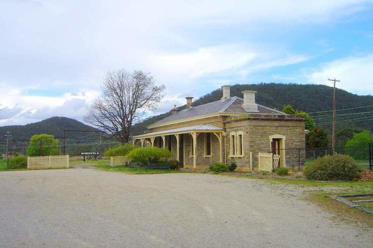
Bowenfels is a small town on the western outskirts of Lithgow, New South Wales, Australia.
Map of South Bowenfels NSW 2790, Australia
Today there are effectively two Bowenfels. Near Lithgow, on the Great Western Highway, is Bowenfels (with the homestead of the valley's first settler, Andrew Brown). About a kilometre south is South Bowenfels. Although both are now essentially suburbs of Lithgow, Bowenfels was, in fact, the first settlement in the valley, predating the existence of Lithgow by nearly 40 years.
Mount Blaxland, a short distance from South Bowenfels, was the furthest point reached by Blaxland, Lawson, and Wentworth on their historic expedition across the Blue Mountains in 1813. Later in that year George Evans followed in the footsteps of the explorers to Mount Blaxland and then headed west to discover the O'Connell plains and the Bathurst plains. At South Bowenfels, Magpie Hollow Road heads west to Lake Lyell and then on to Tarana and O'Connell.
Bowenfels was founded in the 1830s to service travellers along the new road to Bathurst, which opened in 1832, following the opening of the Victoria Pass, which sealed the fate of the old Bathurst road in its descent of Mt. York. It was named by Surveyor-General Thomas Mitchell after George Mears Bowen, a former member of his department. The town was the first settlement in the valley and pre-dated Lithgow by 40 years. The railway opened in 1869, and was electrified in the 1950s, although passenger services no longer service Bowenfels station.