
Area 218 ha | Region Plzeň Postal code 337 01 Population 261 (2001) | |
 | ||
Borek is a Municipal District of the town of Rokycany in Rokycany District, Plzeň Region of the Czech republic.
Contents
Map of Borek, 337 01 Rokycany, Czechia
History
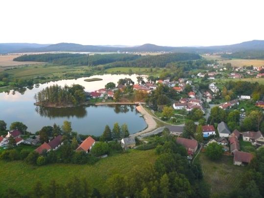
The formerly independent village of Borek is located ca.2 km east of Rokycany's town center. Mentioned for the first time in 1390 („Borek villa ad distr. Rokyczan“). In the 15th century the village was abandoned to be resettled in the 17th century as a small cluster of dwellings centered on the iron mill. It grew further in the 18th and 19th centuries, covering most of the elevated peninsula of Borecký rybník Lake. During the 19th century the built-up area expanded southwards, to the proximity of the major Prague-Plzeň road. In 1960 Borek came under the jurisdiction of Rokycany. In the 20th century the built-up area of Borek further expanded amalgamating the village with Rokycany.
Landmarks
The Borecký rybník Lake is the best known landmark of this Municipal District. Area of the Lake is reported to be 15 hectares or 10 hectares.
Demography
Borek's population saw major growth for most of the 19th century. In the second half of the 20th century it however started to decline significantly. The depopulation slowed recently and as new areas are slated for residential development in Borek the trend is to revert soon.