
OS grid reference NZ095825 Local time Monday 8:00 AM District Castle Morpeth UK parliament constituency Hexham | Sovereign state United Kingdom Postcode district NE61 Dialling code 01661 | |
 | ||
Weather 3°C, Wind W at 10 km/h, 94% Humidity | ||
Bolam is a village in the civil parish of Belsay in Northumberland, England. The village is about 20 miles (32 km) north-west of Newcastle, near Bolam West Houses.
Contents
Map of Bolam, Morpeth, UK
History
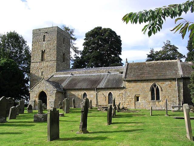
The Church of England parish church of St Andrew has a late Saxon west tower and is a Grade I listed building.
Shortflatt Tower, about 1.5 miles (2.4 km) south-west of the village, is a late 15th or early 16th century pele tower, with a 17th-century house attached, and is also Grade I listed.
Bolam is the burial place of Robert de Reymes, a wealthy Suffolk merchant, who in 1296 began the building of Aydon Castle, near Corbridge.
References
Bolam, Northumberland Wikipedia(Text) CC BY-SA