
Country Canada RCM La Côte-de-Beaupré Time zone EST (UTC−5) Area 21.5 km² Local time Monday 1:22 AM | Region Capitale-Nationale Constituted April 3, 1920 Postal code(s) G0A 1H0 Population 6,465 (2011) Province Québec | |
 | ||
Weather -13°C, Wind SW at 5 km/h, 46% Humidity | ||
Boischatel is a municipality in the Capitale-Nationale region of Quebec, Canada. The town was originally called Saint-Jean-de-Boischatel.
Contents
Map of Boischatel, QC, Canada
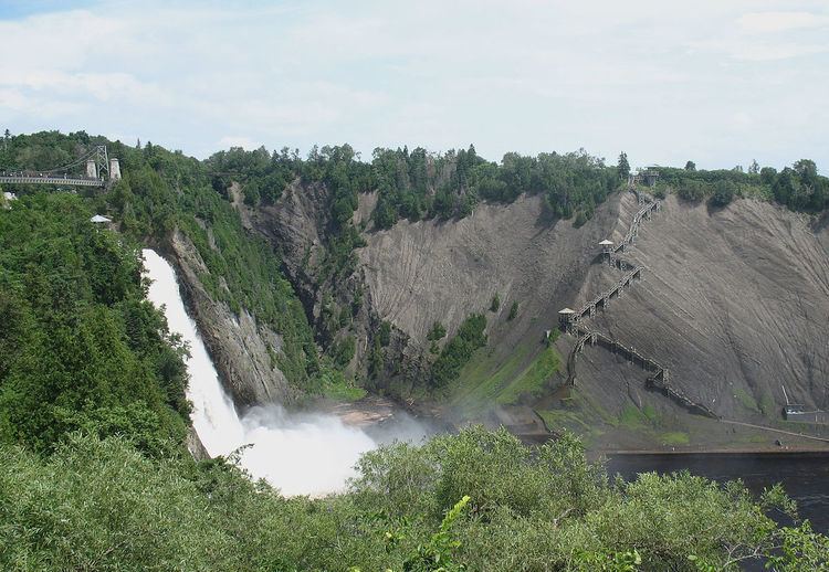
The town itself is located along the Montmorency River. Nearby on the boundary with Beauport are the Montmorency Falls where 35,000 litres of water per second are falling down a height one and a half times greater than the Niagara Falls.
Demographics
Population trend:
Private dwellings occupied by usual residents: 2,331 (total dwellings: 2,382)
First language:
References
Boischatel, Quebec Wikipedia(Text) CC BY-SA