
Country United States FIPS code 29-06742 Elevation 328 m Zip code 64426 Local time Sunday 10:58 AM | Time zone Central (CST) (UTC-6) GNIS feature ID 0714451 Area 80 ha Population 190 (2013) Area code 660 | |
 | ||
Weather 14°C, Wind S at 31 km/h, 67% Humidity | ||
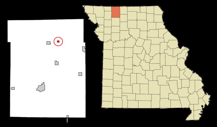
Blythedale is a village in Harrison County, Missouri, United States. The population was 193 at the 2010 census.
Contents
Map of Blythedale, MO 64426, USA
History
Blythedale was laid out in 1880, and named in honor of a railroad employee. A post office called Blythedale has been in operation since 1880.
Geography
Blythedale is located at 40°28′31″N 93°55′39″W (40.475204, -93.927397).
According to the United States Census Bureau, the village has a total area of 0.31 square miles (0.80 km2), all of it land.
2010 census
As of the census of 2010, there were 193 people, 86 households, and 56 families residing in the village. The population density was 622.6 inhabitants per square mile (240.4/km2). There were 105 housing units at an average density of 338.7 per square mile (130.8/km2). The racial makeup of the village was 100.0% White. Hispanic or Latino of any race were 2.6% of the population.
There were 86 households of which 29.1% had children under the age of 18 living with them, 47.7% were married couples living together, 9.3% had a female householder with no husband present, 8.1% had a male householder with no wife present, and 34.9% were non-families. 32.6% of all households were made up of individuals and 17.4% had someone living alone who was 65 years of age or older. The average household size was 2.24 and the average family size was 2.75.
The median age in the village was 43.5 years. 23.8% of residents were under the age of 18; 5.7% were between the ages of 18 and 24; 22.2% were from 25 to 44; 25.9% were from 45 to 64; and 22.3% were 65 years of age or older. The gender makeup of the village was 52.3% male and 47.7% female.
2000 census
As of the census of 2000, there were 233 people, 100 households, and 67 families residing in the village. The population density was 754.3 people per square mile (290.2/km²). There were 111 housing units at an average density of 359.3 per square mile (138.2/km²). The racial makeup of the village was 99.14% White, 0.43% Pacific Islander, and 0.43% from two or more races. Hispanic or Latino of any race were 1.29% of the population.
There were 100 households out of which 30.0% had children under the age of 18 living with them, 48.0% were married couples living together, 8.0% had a female householder with no husband present, and 33.0% were non-families. 29.0% of all households were made up of individuals and 22.0% had someone living alone who was 65 years of age or older. The average household size was 2.33 and the average family size was 2.76.
In the village, the population was spread out with 26.2% under the age of 18, 8.2% from 18 to 24, 26.6% from 25 to 44, 19.7% from 45 to 64, and 19.3% who were 65 years of age or older. The median age was 38 years. For every 100 females there were 109.9 males. For every 100 females age 18 and over, there were 97.7 males.
The median income for a household in the village was $25,417, and the median income for a family was $27,500. Males had a median income of $25,000 versus $13,438 for females. The per capita income for the village was $11,281. About 26.8% of families and 32.4% of the population were below the poverty line, including 53.8% of those under the age of eighteen and 18.9% of those sixty five or over.