
Country United States County Marshall Incorporated March 20, 1872 Elevation 352 m Population 997 (2013) Area code 785 | State Kansas Founded 1869 Time zone CST (UTC−6) Zip code 66411 Local time Sunday 6:08 AM | |
 | ||
Weather 12°C, Wind S at 29 km/h, 78% Humidity Area 5.206 km² (5.154 km² Land / 5 ha Water) | ||
Marshall county fairgrounds blue rapids kansas racing action
Blue Rapids is a city in Marshall County, Kansas, United States. As of the 2010 census, the city population was 1,019.
Contents
- Marshall county fairgrounds blue rapids kansas racing action
- Map of Blue Rapids KS 66411 USA
- Marshall county fairgrounds blue rapids kansas track 1 766
- History
- Geography
- 2010 census
- 2000 census
- Education
- References
Map of Blue Rapids, KS 66411, USA
Marshall county fairgrounds blue rapids kansas track 1 766
History
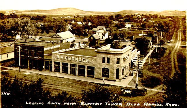
The first endeavor to establish a town below the junction of the rivers, in 1857, failed due to misfortunes of two of the three participants. No further attempt to utilize the impressive water power was made until 1869–1870, when a colony of about 50 families from Genesee County, New York moved in, purchased land and water power rights, and began establishing a community. The Blue Rapids Town Company was formed, and by the end of 1870 the population was about 250. In 1872, Blue Rapids was incorporated as a city of third class under the statutes of Kansas.
Among the first projects in 1870 were a stone dam and a wrought iron bridge built on the Big Blue River. A hydroelectric power plant was then added to provide power for manufacturing and for the town. The power plant was destroyed by a flood in 1903. In the late 19th century and early 20th century there were four gypsum mines in the area. The population peaked around 1910 at over 1,750. The public library, built in 1875, is the oldest library west of the Mississippi in continuous operation in the same building.
Blue Rapids was the birthplace of the pancreatic cancer drug Streptozotocin. The bacterium from which the drug is derived was discovered in the late 1950s in a soil sample taken from "an uncultivated sandy soil in a grassland region" at Blue Rapids.
Blue Rapids claims to be the smallest town in the U.S. to have hosted a national league baseball game. On October 24, 1913, more than 3,000 fans watched the Chicago White Sox and New York Giants play a world tour exhibition game on the local ball field that is still in use today.
In 2001, Blue Rapids became the site of a new NOAA Weather Radio transmitter, KZZ67, to provide weather and emergency information from the National Weather Service in Topeka, Kansas to residents of north-central and northeast Kansas.
In May 2012, "The Monument to the Ice Age" was dedicated in the town square. It features descriptions of Ice Age times, continental glaciers, and Sioux Quartzite glacial erratics -the oldest rocks in Kansas. The main reason for this Ice Age Monument is that Blue Rapids was founded in a place with abundant natural resources brought or created by the glaciers of the Ice Age over 10,000 years ago. The namesake rapids on the Blue River that were harnessed to power early industries, the sand and gravel deposits used for construction and roads, and the rich soils for agriculture are all here because of the Ice Age glaciers. The Monument honors this ancient geological heritage. Glacial erratic that was deposited in the glaciated region of Kansas during the Pleistocene era.
Geography
Blue Rapids is located in northeast Kansas near the junction of the Little Blue and Big Blue rivers, at 39°40′55″N 96°39′33″W. Its elevation is 1,150 feet (350 m) above sea level. Located on highway US-77/K-9, Blue Rapids is 5 miles (8.0 km) east of its sister town Waterville, 12 miles (19 km) south of the county seat Marysville, 13 miles (21 km) west of Frankfort, and 46 miles (74 km) north of the large university town of Manhattan. According to the United States Census Bureau, the city has a total area of 2.01 square miles (5.21 km2), of which, 1.99 square miles (5.15 km2) is land and 0.02 square miles (0.05 km2) is water.
Georgia-Pacific has a gypsum mine near Blue Rapids containing some of the purest gypsum in the world.
2010 census
As of the census of 2010, there were 1,019 people, 415 households, and 263 families residing in the city. The population density was 512.1 inhabitants per square mile (197.7/km2). There were 465 housing units at an average density of 233.7 per square mile (90.2/km2). The racial makeup of the city was 97.2% White, 0.3% African American, 1.1% Native American, 0.6% from other races, and 0.9% from two or more races. Hispanic or Latino of any race were 1.4% of the population.
There were 415 households of which 29.9% had children under the age of 18 living with them, 51.3% were married couples living together, 7.0% had a female householder with no husband present, 5.1% had a male householder with no wife present, and 36.6% were non-families. 32.0% of all households were made up of individuals and 15.9% had someone living alone who was 65 years of age or older. The average household size was 2.37 and the average family size was 3.00.
The median age in the city was 43.2 years. 24.2% of residents were under the age of 18; 4.9% were between the ages of 18 and 24; 22.2% were from 25 to 44; 26.8% were from 45 to 64; and 22% were 65 years of age or older. The gender makeup of the city was 47.6% male and 52.4% female.
2000 census
As of the census of 2000, there were 1,088 people, 439 households, and 295 families residing in the city. The population density was 529 people per square mile (204/km²). There were 494 housing units at an average density of 240/sq mi (93/km²). The racial makeup of the city was 98.07% White, 0.18% African American, 0.09% Native American, 0.09% Asian, 0.37% from other races, and 1.19% from two or more races. Hispanic or Latino of any race were 0.55% of the population.
There were 439 households out of which 30.5% had children under the age of 18 living with them, 56.3% were married couples living together, 6.8% had a female householder with no husband present, and 32.8% were non-families. 30.1% of all households were made up of individuals and 16.2% had someone living alone who was 65 years of age or older. The average household size was 2.39 and the average family size was 2.97.
In the city, the age distribution of the population shows 25.1% under the age of 18, 7.3% from 18 to 24, 23.1% from 25 to 44, 22.3% from 45 to 64, and 22.2% who were 65 years of age or older. The median age was 41 years. For every 100 females there were 94.3 males. For every 100 females age 18 and over, there were 93.6 males.
The median income for a household in the city was $30,682, and the median income for a family was $37,273. Males had a median income of $30,066 versus $18,214 for females. The per capita income for the city was $16,859. About 9.3% of families and 13.0% of the population were below the poverty line, including 17.2% of those under age 18 and 4.4% of those age 65 or over.
Education
Blue Rapids is served by USD 498 Valley Heights. Valley Heights Jr/Sr High School is located halfway between the towns of Blue Rapids and Waterville. The Valley Heights mascot is Mustangs.
Blue Rapids High School was closed through school unification. The Blue Rapids Pirates won the Kansas State High School boys class B Track & Field championship in 1942.