
- right Potomac River - elevation 176 m (577 ft) | - elevation 381 m (1,250 ft) | |
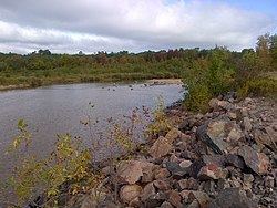 | ||
The Blind River is a river in the municipality of Blind River, Algoma District in Northeastern Ontario, Canada. The river is in the Great Lakes Basin and is tributary of Lake Huron.
This river was called a "blind river" because the river's mouth is not easily seen from the lake. Its native (Ojibway) name is "biniwaabikong", which means "at the fallen rock" due to the smooth, sloping rock face along the river.
The river flows south from Pathfinder Lake through a group of other lakes and empties into the North Channel of Lake Huron at the central community of Blind River.
A sawmill was built near the mouth of this river in 1837. There is a small hydroelectric plant where the river drains Lake Duborne.
TributariesEdit
References
Blind River (Ontario) Wikipedia(Text) CC BY-SA