
Basin countries United Kingdom | Surface elevation 497 m | |
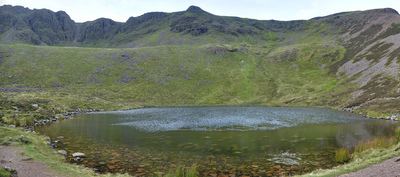 | ||
Bleaberry Tarn is a small natural mountain tarn near Buttermere in the English Lake District. Located at NY165154 (OS Landranger 89), it lies in a corrie below the Lakeland fells of Red Pike and High Stile, backed by Chapel Crags on the ridge between them. The footpath ascending Red Pike from Buttermere skirts its north side.
Map of Bleaberry Tarn, Cockermouth, UK
The stream Sour Milk Gill descends from the tarn to Buttermere, and is followed by one of the popular footpaths ascending Red Pike.
References
Bleaberry Tarn Wikipedia(Text) CC BY-SA