
OS grid reference SK004018 | Sovereign state United Kingdom | |
 | ||
Population 12,022 (2011.Blakenhall Ward) Restaurants Panka Walla, Blakenall One Call Peri Peri, Golden Flavour, Field Road Fish Bar, Blakenall Fish Bar | ||
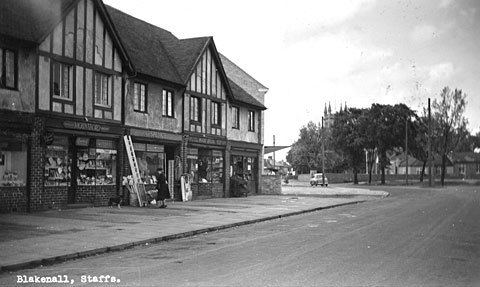
Blakenall Heath is a neighbourhood in Walsall, West Midlands, England. It straddles the border of Walsall and neighbouring town Bloxwich.
Map of Blakenall Heath, Walsall, UK
It was originally a rural area north of Walsall, but the face of the area changed dramatically between 1918 and 1939.
Farmland gave way to council housing, which surrounded the local church and a few pre-1914 buildings, and further developments took place in the thirty years following the end of the Second World War. Walsall borough's first council house was built in Blakenall Heath, on Blakenall Lane, during June 1920. Within seven years, 500 council houses had been built in the area, and by 1939 more than 1,000 had been built. Several hundred more had followed by the early 1970s. These were divided between established neighbourhoods in areas like Blakenall Lane and Harden Road, and new housing estates with themed street names; including the 1930s Poet's Estate (where road names included Shakespeare Crescent, Goldsmith Road and Tennyson Road) and the 1940s/1950s Rivers Estate (where road names included Thames Road, Wye Road and Mersey Road).
Blakenall Heath is the centre of the Blakenall ward of Walsall, which has the highest poverty and crime rates in the Metropolitan Borough of Walsall. It has been targeted for regeneration as part of the government's New Deal project since 2001.
Improvements are well underway, with several hundred homes either demolished or due to be demolished, and replaced by a mix of private and rented houses and flats. The regeneration is only in its early stages, and completion is not expected for several years yet.
Most of the demolition has (or is scheduled to) take place around Walker Road, Well Lane, Barracks Lane and Taylor Avenue.
The area is often confused with the Blakenhall area of nearby Wolverhampton. In fact, even Walsall Council have been known to misspell 'Blakenall' on road and direction signs.
The parish church for Blakenall Heath is Christ Church, which is constructed from limestone and opened in 1872 when the surrounding area was still half a century away from its transformation from rural to urban.