
Website blaine.okcounties.org Founded 1890 Unemployment rate 3.5% (Apr 2015) | Area 2,432 km² Population 9,720 (2013) | |
 | ||
Rivers Canadian River, Cimarron River, North Canadian River | ||
Blaine County is a county located in the U.S. state of Oklahoma. As of the 2010 census, the population was 9,785. Its county seat is Watonga. Blaine County is the birthplace of voice actor Clarence Nash, the voice of Disney's Donald Duck.
Contents
- Map of Blaine County OK USA
- History
- Government
- Geography
- Major highways
- Adjacent counties
- Demographics
- Economy
- NRHP sites
- References
Map of Blaine County, OK, USA
Part of the Cheyenne-Arapaho land opening in 1892, the county had gained rail lines by the early 1900s and highways by the 1930s. The county was named for James G. Blaine, an American politician who was the Republican presidential candidate in 1884 and Secretary of State under President Benjamin Harrison.
History
Blaine County was one of several counties created by the Land Run of 1892. It was designated as county "C" beginning in 1890 before the land run. The area was settled by Creek and Seminole, who the federal government relocated to the area in the 1820s and 1830s. The Cheyenne and Arapaho tribes were relocated to the area from Colorado in 1869, after the Reconstruction Treaties of 1866 had taken the land back from the Creek and Seminole.
The land run was held after giving members of the tribe allotments of 160 acres (0.65 km2) each.
A post office established in the county seat of Watonga, Oklahoma the same year as the land run. The Enid and Anadarko Railway and the Blackwell, Enid and Southwestern Railroad both ran lines through the county from 1901 to 1903. The Blaine County Courthouse was built in 1906.
The town of Geary, which also received a post office in the same year as the land run, became an agricultural trade center in the county and had a population of 2,561 by 1902. The town was home to "the oldest bank in Blaine County." Okeene was also established in the year of the land run and was surrounded by farmers of German descent.
The county's population was 17,227 in 1907 and rose to 17,960 in 1910. It had declined to 15,875 by 1920.
The U.S. highway system reached Oklahoma in 1926. U.S. Highways 270 and 281 were constructed through Blaine County. The county was also served by the Postal Highway as early as 1912; it later became part of U.S. Highway 66.
The county's population peaked at 20,452 in 1930. New Deal programs such as the Civilian Conservation Corps employed county residents and built Roman Nose State Park, which opened in 1937.
By the 21st century, the county had a population of 11,976.
Government
The county is served by seven elected county officials: a county sheriff, three county commissioners, a county clerk, a county assessor, and a county treasurer. The three commissioners each have districts with approximately equal populations based on the latest census. The county government is primarily housed in the Blaine County Courthouse in Watonga, Oklahoma.
Geography
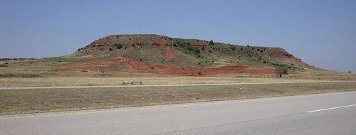
According to the U.S. Census Bureau, the county has a total area of 939 square miles (2,430 km2), of which 928 square miles (2,400 km2) is land and 10 square miles (26 km2) (1.1%) is water. The northeastern half of the county is located on the western edge of the Red Bed Plains while the southwestern half lies in the Gypsum Hills. The North Canadian River runs through the county from northwest to southeast.
The county includes the largest lake in western Oklahoma, Canton Lake.
The county seat of Watonga hosts an annual cheese festival in October, celebrating the city's cheese factory.
Major highways
Adjacent counties
Demographics
As of the census of 2000, there were 11,976 people, 4,159 households, and 2,865 families residing in the county, nearly half of them located in the county seat of Watonga. The population density of the county was 13 people per square mile (5/km²). There were 5,208 housing units at an average density of 6 per square mile (2/km²). The racial makeup of the county was 76.29% white, 8.70% Native American, 6.65% Black or African American, 0.71% Asian, 0.81% Pacific Islander, 2.86% from other races, and 3.97% from two or more races. Hispanic or Latino individuals of any race made up 6.62% of the population.
There were 4,159 households out of which 30.80% had children under the age of 18 living with them. Slightly more than half (56.20%) were married couples living together, nearly a third (29%) were made up of individuals, 15.5% had someone living alone who was 65 years or age or older, and 8.6% were run by a female with no husband present. The average household size was 2.50 and the average family size was 3.08.
The median age of the county in 2000 was 38 years, with almost a third (28.6%) of the population aged 25 to 44. Individuals under the age of 18 made up 24% of the population, individuals age 45 to 64 made up 21.4% of the population, individuals age 65 or older made up 16.8% of the population, and individuals between the ages of 18 to 24 made up 9.1% of the population. There were slightly more males than females, with 119.3 males for every 100 females and 125 adult males (18 or older) for every 100 female adults.
The median income for a household in the county in 2000 was $28,356, and the median income for a family was $34,565. Males had a median income of $26,284 versus $18,619 for females. The per capita income for the county was $13,546. About 12.8 percent of families and 16.9% of the population were below the poverty line, including 22.2% of those under age 18 and 13.2% of those age 65 or over.
Economy
Southard, located in central Blaine County, is the site of one of the purest gypsum deposits in the United States and is home to The U.S. Gypsum Company, the largest industrial plant in the county.
Lying in the Cimarron Valley, Okeene's economy has been based in agriculture, primarily wheat and hay. Major manufacturing businesses are the Okeene Milling Company, Seaboard Farms, and Mountain Country Foods, a manufacturer of pet food. The Okeene Municipal Hospital and Clinic is one of the primary medical centers of northwest Oklahoma.
NRHP sites
The following sites in Blaine County are listed on the National Register of Historic Places: