
Country United States of America | Bridges Keniston Bridge | |
 | ||
The Blackwater River is a 37.5-mile-long (60.4 km) river located in central New Hampshire in the United States. It is a tributary of the Contoocook River, part of the Merrimack River watershed.
Map of Blackwater River, New Hampshire, USA
The Blackwater River is formed at Cilleyville, a village in the western part of the town of Andover, by the junction of two branch streams that lack official names on current maps. The western branch begins at the outlet of Pleasant Lake in New London and flows east through Chase and Tannery ponds in Wilmot Flat. The northern stream branch begins at the outlet of Eagle Pond in Wilmot and flows south past West Andover and through Bog Pond, joining the outlet of Pleasant Lake just south of the outlet of Bog Pond. Kimpton Brook (formerly known as Quickwater Brook), flowing easterly through the village of Wilmot Center, is the primary tributary of Eagle Pond.
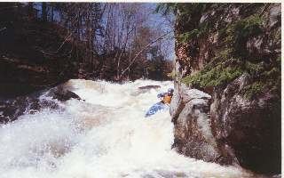
From its start at Cilleyville, the Blackwater River flows east through the town of Andover, passing the village of Potter Place. Beyond Andover village, the river continues to wind its way east, eventually turning south near the Blackwater Bays and dropping over rapids through the village of West Salisbury to the impoundment area of the Blackwater Dam in the town of Webster. Below the reservoir dam, the Blackwater encounters a short, intense whitewater stretch before flattening again for the final miles to the Contoocook in Hopkinton.