
Phone +1 401-762-0250 | ||
 | ||
Hours Open today · Open 24 hoursSaturdayOpen 24 hoursSundayOpen 24 hoursMondayOpen 24 hoursTuesdayOpen 24 hoursWednesdayOpen 24 hoursThursdayOpen 24 hoursFridayOpen 24 hours Similar Blackstone River and Canal He, Blackstone River Valley Na, Blackstone River Valley Na, World War II Veterans Memorial, Bedford Depot | ||
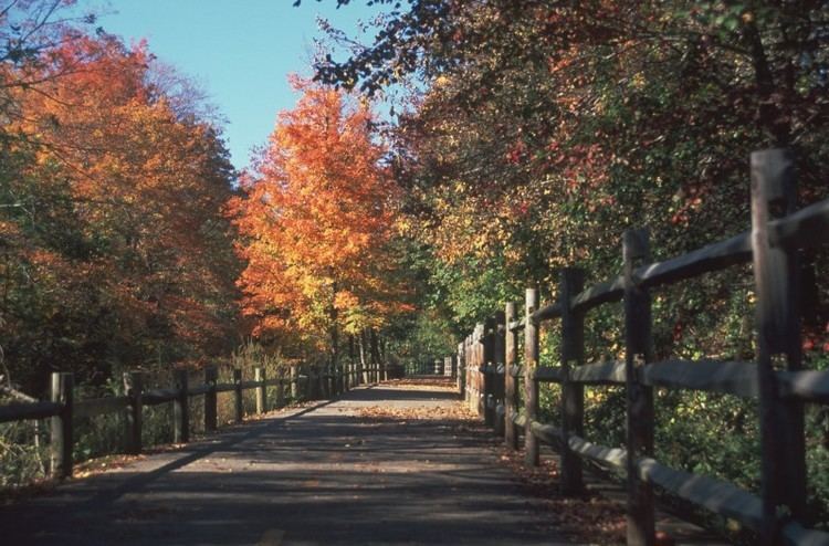
The Blackstone River Greenway (formerly Bikeway) is a partially completed 48-mile (77 km) paved rail trail defining the course of the East Coast Greenway through the Blackstone Valley from Worcester, Massachusetts to Providence, Rhode Island.
As of 2016, approximately 11.5 miles (18.5 km) of the trail has been completed in Rhode Island, connecting the communities of Woonsocket, Lincoln, Cumberland, and Manville. Some 2.5 miles (4.0 km) of completed trail in Massachusetts connect Worcester and Millbury, as well as 3.7 miles of trail connecting Uxbridge and Blackstone.
The path follows the right-of-way of the old Providence and Worcester Railroad and its predecessor, the Blackstone Canal, running alongside the Blackstone River. Once constructed, the greenway will be linked to the East Bay Bike Path, for an additional 14.5 miles (23.3 km) of trail to Bristol, Rhode Island. The Blackstone River Greenway is also a designated section of the East Coast Greenway, the 3,000-mile trail system connecting cities from Maine to Florida.
History
In 1985, the Blackstone River Valley National Heritage Corridor (known after 1999 as the John H. Chafee Blackstone River Valley National Heritage Corridor) was designated by the United States Congress, following the path of the Blackstone River from Providence to Worcester.
In 1997, the Rhode Island Department of Environmental Management and Department of Transportation began work on the first Rhode Island segment, from Lincoln to Ashton. This segment was completed in 1998. A second Rhode Island segment was completed in 2002, from Ashton to Manville. In August 2007, a bridge reconstruction project at Martin Street in Lincoln was completed, ending a three-year bike path closure. The new bridge incorporated a major safety improvement with the path passing underneath Martin Street instead of meeting it at grade. In November 2007, a 2-mile (3.2 km) extension from Manville to the Woonsocket Water Treatment Plant was opened. A 1-mile (1.6 km) segment from Lonsdale to Valley Falls, which includes more than 500 feet (150 m) of boardwalk over part of the Lonsdale Marsh, opened in 2008. A segment through the River's Edge Recreational Complex in Woonsocket was completed in 2008, and that segment was linked to the previously-completed portions to the south later that year. The path was about 10 miles (16 km) long as of mid-2009. Additional segments are under design to extend the path further through Woonsocket toward the Massachusetts border and south into Central Falls and Pawtucket. In 2011, an 8.5 mile segment of on-road bicycle lanes opened connecting the Blackstone River Greenway with the East Bay Bike Path, starting in Providence. In 2013, sharrows were painted through Woonsocket from the Massachusetts border to the River's Edge Recreational Complex.
In 1996, a study undertaken by the Massachusetts Highway Department (MHD) and the Massachusetts Department of Conservation and Recreation (known at the time as the Department of Environmental Management) produced a plan for seven segments of trail linking Worcester with Blackstone, Massachusetts and the Rhode Island border.
- Blackstone to Millville (2.92 miles)
- Millville to Uxbridge (3.30 miles)
- Uxbridge to Northbridge (9.09 miles)
- Northbridge to Grafton (1.39 miles)
- Grafton to Millbury via Sutton (6.02 miles)
- Millbury to Worcester (4+ miles)
- Worcester (2.61 miles)
Construction was delayed due to a lack of state funds, a shortfall attributed to the over-budget "Big Dig" highway tunnel project in Boston. In 2005, as part of the Massachusetts Turnpike-Route 146 interchange project, the first 2.5-mile (4.0 km) segment, from Worcester to Millbury, was opened to the public.
In 2010, an agreement was reached between MassDOT and DCR for DCR to take over the management of the design and environmental permitting of Sections 1 through 5 of the Greenway, including preparation of the Environmental Impact Report (EIR). Section 6 was previously constructed by MassDOT, and Section 7 will be designed by the City of Worcester, and constructed by MassDOT.
In 2013, five bridges in Blackstone that run concurrently with the Southern New England Trunkline Trail (SNETT) were repaired and repainted. These are the two Factory Pond Bridges, the northern Canal Street Bridge, a Blackstone River Bridge, and the St. Paul Street Bridge. By September 2014, these bridges received new ipe wood decks and safety railings. Also in 2014, it is expected that new bridges will be built across Kane Court and Main Street in Blackstone and that a tunnel (box culvert) will be built under Church Street in Blackstone. Further 2014 work is expected to include repair and decking of the Triad bridge and footway resurfacing from St. Paul Street in Blackstone to Rte. 146A in Uxbridge. East of St. Paul Street, Blackstone, the future of the second Canal Street Bridge and the two concrete arch viaducts (one of seven arches) is undecided. All of the trail between the missing Blackstone River and Rte. 122 bridge in Blackstone and Rte. 146A in Uxbridge is part of both the SNETT and the Blackstone River Greenway.