
- elevation 3,740 ft (1,140 m) - elevation 1,700 ft (518 m) Basin area 1,295 km² Source Dry Fork Mouths Parsons, Cheat River | - elevation 3,540 ft (1,079 m) Length 6 km Basin area 1,295 km² Country United States of America | |
 | ||
- location Col between Harper and Yokum knobs, Randolph County, West Virginia - location Canaan Valley, Tucker County, West Virginia - location Hendricks, West Virginia | ||
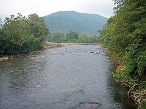
The Black Fork is a principal tributary of the Cheat River in the Allegheny Mountains of eastern West Virginia, USA. It is a short stream, about four miles (6 km) in length, formed by the confluence of two other streams not far above its mouth. It was traditionally considered one of the five Forks of Cheat.
Contents
Map of Black Fork, WV, USA
GeographyEdit
Via the Cheat, Monongahela and Ohio Rivers, it is part of the watershed of the Mississippi River, draining an area of 500 square miles (1,295 km²). The Black Fork flows for its entire length in Tucker County. It is formed at the town of Hendricks by the confluence of the Dry Fork and the Blackwater River, and flows generally northwestwardly through Hambleton to Parsons, where it joins the Shavers Fork to form the Cheat River.
NameEdit
The U.S. Board on Geographic Names settled on "Black Fork" as the stream's name in 1930. According to the Geographic Names Information System, it has also been known historically as "Blackwater Fork" and as the Blackwater River.