
Location Sunnmøre, Norway Width 600 m (2,000 ft) Highest elevation 124 m (407 ft) Elevation 124 m Municipality Haram | Length 3 km (1.9 mi) Coastline 10 km (6 mi) Highest point Bjørnøyfjella Area 180 ha | |
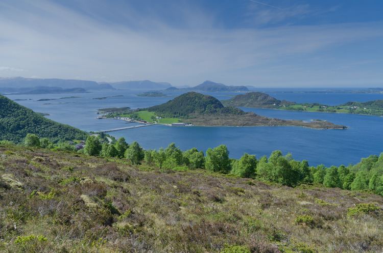 | ||
Bjørnøya (English: Bear Island) is a populated island in Haram Municipality in Møre og Romsdal county, Norway. It is connected to the Norwegian mainland through a man-made causeway. The nearest larger village on the mainland is Søvik. To the east of the Bjørnøya (between Bjørnøya and Søvik) lies the island of Terøya. The two islands are separated by the Bjørnøysundet. The island was part of the former municipality of Borgund until 1965 when it joined Haram.
Map of Bj%C3%B8rn%C3%B8ya, 6280 S%C3%B8vik, Norway
There are several hamlets on the island, the notable ones among them are Bjørnøya and Fagerheim. The children on the island are served by the school in Søvik, just 6 kilometres (3.7 mi) to the southeast.
The highest point on Bjørnøya is the 124-metre (407 ft) tall Bjørnøyfjellet. A marked path leads up to the top. Another moderately-high peak on the central-north part of the island rises to elevation of 80 metres (260 ft). Other attractions on the island include the Bjørnøya coastal fort (Bjørnøya Kystfort) in the south. There are also beaches, forests, and wetlands (Tangane) in the northeast part of the island. The municipality of Haram has plans to develop two preserves on the island: one preserving shores and the other preserving the wetlands.