
Admin. region Darmstadt Time zone CET/CEST (UTC+1/+2) Area 24.56 km² Postal code 69488 Administrative region Darmstadt | District Bergstraße Postal codes 69488 Population 10,043 (30 Jun 2009) Local time Thursday 10:43 AM Team TSV Birkenau | |
 | ||
Weather 8°C, Wind SW at 29 km/h, 58% Humidity | ||
Birkenau in the Odenwald is a community in the Bergstraße district in southern Hesse, Germany. Its nickname is Das Dorf der Sonnenuhren – “The Sundial Village”.
Contents
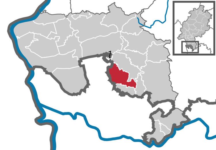
- Map of Birkenau Germany
- Location
- Neighbouring communities
- Constituent communities
- Climate
- History
- Community council
- Town partnerships
- Coat of arms
- Tourism
- Transport
- Public institutions
- Education
- Buildings
- Nature
- Sport
- References
Map of Birkenau, Germany
Location
The community lies in the Weschnitz valley in the Odenwald some 25 km north of Heidelberg and about 20 km northeast of Mannheim. It is on Bundesstraße 38, and the river Weschnitz flows through it. The land is hilly, green and dotted with horse farms and forests.
Neighbouring communities
Birkenau borders in the north on the community of Mörlenbach, in the east on the community of Abtsteinach, in the south on the community of Gorxheimertal and in the west on the towns of Weinheim and Hemsbach (both in Rhein-Neckar-Kreis in Baden-Württemberg).
Constituent communities
Birkenau’s Ortsteile are Birkenau, Buchklingen, Hornbach, Kallstadt, Löhrbach, Nieder-Liebersbach, Reisen and Schnorrenbach.
Climate
Owing to its location near the Bergstraße, a mild climate prevails in Birkenau, which can often be seen in what for Germany is a very early blossoming of almond trees.
History
Birkenau had its first documentary mention in 795 in the Lorsch Codex as a cell of the Lorsch Abbey. As one of the Abbey’s holdings, it passed into the ownership of the Archbishopric of Mainz in 1232. The centres of Hornbach and Balzenbach, on the other hand, belonged to the Electorate of the Palatinate, meaning that after the Reformation, they belonged to different denominations. In 1532 the town hall was built, and in 1771 the palace, Schloss Birkenau, of the Lords of Wambolt von Umstadt. By 1964, the population had grown to more than 5,000. In 1967 the community was recognized as a recreational resort (Erholungsort) and in 1979 as an open-air resort (Luftkurort). Owing to the only slight tourism, however, it has not reapplied for this designation. In 1995, Birkenau celebrated its 1,200-year jubilee.
Community council
The municipal election held on 26 March 2006 yielded the following results:
Town partnerships
Coat of arms
The community’s arms might be described thus: Gules an uprooted birch tree overlaid with a wall anchor argent.
What the arms, whose charges can be partly traced in tithing seals and boundary stones back to the 16th century, mean is unclear. The charge that the German blazon describes as a “wall anchor” (Maueranker) is not accepted as such by everyone, with some saying it could have been meant to be taken as a weaver’s reel. With a document from 22 July 1926, the interior minister of the People's State of Hesse granted the community the right to bear these arms.
Tourism
In the Birkenau constituent community of Schnorrenbach is found a winter sport area with a 450 m-long downhill skiing slope and a skilift. In summer, grass skiing is possible. Floodlights have also been installed.
Transport
Birkenau lies in the area served by the Verkehrsverbund Rhein-Neckar, a transport authority serving the Rhine Neckar Area. Birkenau railway station is on the Weschnitztalbahn (railway; Weinheim–Fürth (Odenwald)). DB Regio AG’s Regionalbahn trains stop there hourly, and half-hourly during weekday peak times.
Until 1999, Bundesstraße 38 ran through Birkenau. With the opening of the Saukopftunnel, this road’s route has been effectively shifted out of the community; the “old B 38” is now the Landesstraße 3408.
Public institutions
Education
Buildings
Nature
Around Birkenau are several nature conservation areas and a considerable number of hiking paths. These are found on the one hand in the woods around Birkenau, but on the other hand, the Höhenweg (“Height Way”, European walking route E1, plateau path between Birkenau and Reisen), for example, is also worth visiting, as there is a striking view over Birkenau and Nieder-Liebersbach.
In Birkenau’s woods it is not uncommon to see local wildlife, such as deer, various birds, hares, and so on. Here and there, foxholes are also to be found.
Sport
Nationally known is the TSV Birkenau (gymnastic and sport club) for its team handball division. The team played in the first Bundesliga and in 1974 became the last official German champions in field handball.