Metropolitan borough Kirklees Sovereign state United Kingdom Postcode district HD2 Dialling code 01484 | Country England Post town HUDDERSFIELD Metropolitan county West Yorkshire | |
 | ||
Region Yorkshire and the Humber | ||
Birkby is a large multi-cultural suburb close to the town centre in Huddersfield, in the Kirklees borough of West Yorkshire, England. It has a population of 6,700.
Map of Birkby, Huddersfield, UK
It has a catholic primary school, St. Patrick's, as well as Birkby Infant and Nursery School, located on Blacker Road. Birkby Junior School is located to the east of Birkby and is addressed as Fartown, Huddersfield. Birkby is a semi-rural area, home to a large white and Asian population, having four mosques. Elsewhere, the suburb contains two Church of England chapels, a Buddhist centre, as well as a meetinghouse for The Church of Jesus Christ of Latter-day Saints. The centre of Birkby, located around the east of Blacker Road and the north of St John's Road, has a high concentration of Asian retailers and food outlets, serving the local Asian community.
It is believed that the name Birkby means "a village inhabited by people of both Viking and ancient Briton origins".
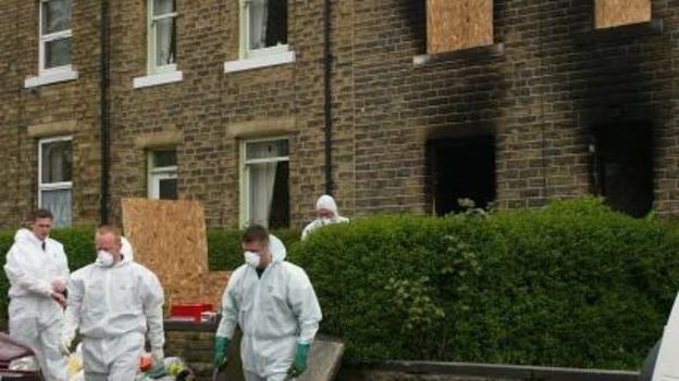
On Sunday 12 May 2002, an arson attack took place at 40 Osborne Road, Birkby, killing 7 people, including a six-month-old girl. All had been sleeping whilst the house was deliberately set on fire. One of the arsonists, Shaheed Mohammed, is still at large and an appeal was made to the public in early 2013 to try to find his whereabouts.
From the study of old Ordnance Survey maps, much of the district of Birkby remained largely rural well into the 20th century, with the original settlement lying close to the town centre. Bay Hall, a local historic house dates from the 16th century but was largely restored in 1895, as a date plaque on the residence indicates. Birkby can effectively be bisected into two distinct areas; St Johns road being the main thoroughfare. Birkby is generally more affluent to the north and west of the main thoroughfare. This can be seen with a comparison of a south Birkby postcode HD2 2RT having an average home price of £121,892 and a northern Birkby postcode of HD2 2DU having an average home price of £450,000, although this shows anomalies and is not a general trend. Recently, Birkby has seen significant residential development, as the Hopkinson's Valve Works has been redeveloped for housing.
An affluent suburb during Victorian times, Birkby sits in the Grimescar Valley, a greenbelt area of Huddersfield. Birkby contains Norman Park, a small park with a play area and war memorial, which commemorates those who died in the First World War.
