Intercommunality Sud Pays Basque Area 11.04 km² | Canton Hendaye Population (2009) 989 Local time Thursday 10:27 AM | |
 | ||
Weather 13°C, Wind NE at 2 km/h, 77% Humidity | ||
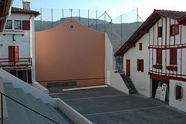
Biriatou (Basque Biriatu) is a village in the traditional Basque province of Labourd, now a commune in the Pyrénées-Atlantiques department in southwestern France.
Map of Biriatou, France
The village lies on the edge of a hill rising east to the minor mount Xoldokogaina (486 m), the first noticeable prominence across the Spanish-French border at the lower Bidasoa. The hiking trail GR 10 crosses the village, heading east through the southern side of Xoldokogaina.
European road carriers and travellers are acquainted with the name, Basque for 'gate/pass of the way' (bide + ate), on account of the border customs and toll at the AP-8 - A-63 motorway to the west of the actual village, often jammed with vehicles and long queues.
References
Biriatou Wikipedia(Text) CC BY-SA
