
Time zone PST (UTC+8) Dialing code 55 Area code 55 Dialling code 55 | Barangays ZIP code 6410 Area 24.62 km² | |
 | ||
Neighborhoods Progress, Apis, Poblacion, Santo Niño | ||
Biri island northern samar
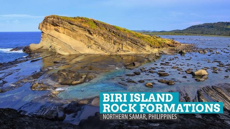
Biri is a fifth class municipality in the province of Northern Samar, Philippines. According to the 2015 census, it has a population of 11,767 people. The municipality is facing Pacific Ocean to the east and San Bernardino Strait to the west. It consists of several islands off the northern coast of Samar Island, the largest of which is Biri Island. Other larger islands are Talisay, Magasang, and Cagnipa. Biri Island is notable for a large number of unusual rock formations along the northern shore, facing the Philippine Sea. It is included in the marine protected area known as Biri Larosa Protected Landscape and Seascape.
Contents
- Biri island northern samar
- Map of Biri Northern Samar Philippines
- Barangays
- Mangrove reforestation
- Biri Initiative Org
- References
Map of Biri, Northern Samar, Philippines
Barangays
Biri is politically subdivided into 8 barangays.
Mangrove reforestation
In 2007, the Community-Based Mangrove Protection and Management project was implemented in Biri, funded by the Philippine Tropical Forest Conservation Foundation (PTFCF). The project aimed to contribute to the regeneration of the mangrove ecosystem by establishing a community-based mangrove management system. The project covered protection of 546 hectares and enhancement planting in 39 hectares. As of 2013, it has been expanded to all eight barangays in Biri.
Biri Initiative Org.
In 2012, a non-profit organization, Biri Initiative Org., was registered with the Philippine Securities and Exchange Commission. Its main objectives are to restore areas of coral reef damaged by illegal fishing methods, promote sustainable and environment-friendly methods of fishing, and encourage opportunities for alternative livelihoods, particularly for women.