
- location near Pilot Rock - location near Rieth Basin area 753.7 km² Country United States of America | - elevation 1,622 ft (494 m) - elevation 958 ft (292 m) Mouth Umatilla River | |
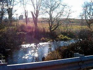 | ||
Birch Creek is a 16-mile (26 km) tributary of the Umatilla River in eastern Oregon in the United States. It rises at the confluence of East and West Birch creeks south of Pilot Rock, Oregon, at the base of the Blue Mountains and flows north, slightly west of the city of Pendleton. It enters the Umatilla River about 49 miles (79 km) from the larger stream's confluence with the Columbia River.
Map of Birch Creek, Oregon, USA
Birch Creek is one of the rivers that drain Oregon's northwestern corner of the Blue Mountains, flowing alongside industrial waste ponds, and over two minor impoundments before reaching the Umatilla River. Lands in the Birch Creek drainage are used for logging, grazing, dairy farming, and factory farming. Birch Creek is a source of phosphates and the resulting eutrophication of the Umatilla River.
Pendleton photographer Walter S. Bowman is believed to have been born by Birch Creek.