Elevation 1,762 m (5,781 ft) | Easiest route road | |
 | ||
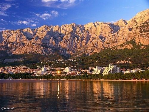
Biokovo ([bîɔkɔʋɔ]) is the second-highest mountain range in Croatia, located along the Dalmatian coast of the Adriatic Sea, between the rivers of Cetina and Neretva. It is sometimes referred to as Bijakova, especially among inhabitants of the eastern side of the mountain. Its highest peak is Sveti Jure (Saint George), at 1762 m.a.s.l. It shows a typical karst landscape.
Map of Biokovo, 21300, Makarska, Croatia
Atop the peak there is a powerful FM and DVB-T transmitter.
The 196 km2 of its area is protected as a nature park with over 1,500 plant and animal species, some of which are endemic.
Biokovo is one in a line of Dinaric Alps stretching along the Dalmatian coast - northwest of it is Mosor and southeast of it are Sutvid and Rilić. In the east, the Šibenik runs in parallel. When the weather is very clear, from the top of Biokovo it is possible to see Monte Gargano in Italy, which is 252 km (157 mi) away.
To aid the hikers, there is the Biokovo Nature Park Visitor Center in downtown Makarska. However, Biokovo can be perilous if hiking unprepared - tourists erroneously imagine peaks to be closer than they are and, oblivious to the danger, have been known to go hiking wearing flip-flops, without water, wearing shirts with military camouflage patterns making them harder to spot for search and rescue teams. From 1976 to 2007 24 hikers have died on Biokovo, while 37 had to be rescued.
