
Time zone CET (UTC+1) Area code 0186, 078 Area 54.91 km² | Elevation −1 m (−3 ft) Postcode 3270–3274, 3295–3299 Website www.binnenmaas.nl Local time Saturday 7:55 AM | |
 | ||
Weather 10°C, Wind SE at 16 km/h, 95% Humidity | ||
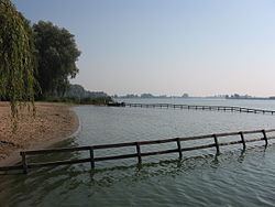
Binnenmaas ( [ˈbɪnə(n)maːs]) is a municipality in the western Netherlands, in the province of South Holland. The municipality had a population of 28,670 in 2014, and covers an area of 75.57 km2 (29.18 sq mi) of which 6.31 km2 (2.44 sq mi) is water. It is named after the lake of the same name.
Map of Binnenmaas, Netherlands
The municipality was formed on January 1, 1984, by the merger of the municipalities Puttershoek, Maasdam, Mijnsheerenland, Westmaas, and Heinenoord. On January 1, 2007, the municipality 's-Gravendeel was added to Binnenmaas.
The municipality of Binnenmaas consists of the following communities: Blaaksedijk, De Wacht, Goidschalxoord, 's-Gravendeel, Greup, Heinenoord, Kuipersveer, Maasdam, Maasdijk, Mijnsheerenland, Puttershoek, Reedijk, Schenkeldijk, Sint Anthoniepolder, Westdijk, Westmaas and Zwanegat.
Dutch Topographic map of the municipality of Binnenmaas, June 2015.