
District Lone district Time zone PST (UTC+8) Local time Thursday 5:24 AM | Barangays Area 70.3 km² | |
 | ||
Weather 24°C, Wind NE at 8 km/h, 87% Humidity | ||
Biliran, officially the Municipality of Biliran (Waray: Bungto san Biliran; Cebuano: Lungsod sa Biliran; Filipino: Bayan ng Biliran), is a municipality in the province of Biliran in the Eastern Visayas (Region VIII) of the Philippines. The population was 16,882 at the 2015 census. In the 2016 electoral roll, it had 11,711 registered voters.
Contents
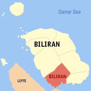
Map of Biliran, Philippines
Geography
Biliran is located at 11°28′N 124°29′E.
According to the Philippine Statistics Authority, the municipality has a land area of 70.3 square kilometres (27.1 sq mi) constituting 7001131200000099999♠13.12% of the 536.01-square-kilometre- (206.95 sq mi) total area of Biliran.
Barangays
Biliran is politically subdivided into 11 barangays.
Demographics
In the 2015 census, Biliran had a population of 16,882. The population density was 240 inhabitants per square kilometre (620/sq mi).
In the 2016 electoral roll, it had 11,711 registered voters.