
Airport type Public Elevation AMSL 899 ft / 274 m 5,035 1,535 Elevation 274 m | Location Bilaspur, Chhattisgarh 17/35 5,035 Code PAB Phone 093007 77184 | |
 | ||
Operator Airports Authority of India Address Tilsara, Chhattisgarh 495220 Similar Bilaspur Junction, Belha Railway Station, Chakarbh Station, Dadhapara Station, Dagori Station | ||
Bilaspur Airport (IATA: PAB, ICAO: VEBU) is located at the village of Chakarbhatta, 10 km south of Bilaspur, in the state of Chhattisgarh, India. It is owned by the Airports Authority of India. It is currently being used for general aviation and pilot training.
The Indian Army intends to take over the airport and establish a training facility for the special forces. The existing para-military commando training facility at Nahan, Himachal Pradesh is to be shifted to Bilaspur, Chhattisgarh. The Army wants use of the entire airport while AAI has made a “conditional offer” of parting with 377 acres while retaining 56 acres for a civil enclave.
There are two additional airstrips on Kota Road/Mohanbhata and Mulmula - that have been lying unused since the Second World War. These are under the Defense Ministry. - Mohanbhatha, Chhattisgarh 495112, Coordinates: 22.242859, 82.026388 - Mulmula, Chhattisgarh Coordinates: 21°56'44.0"N 82°20'42.6"E
Structure
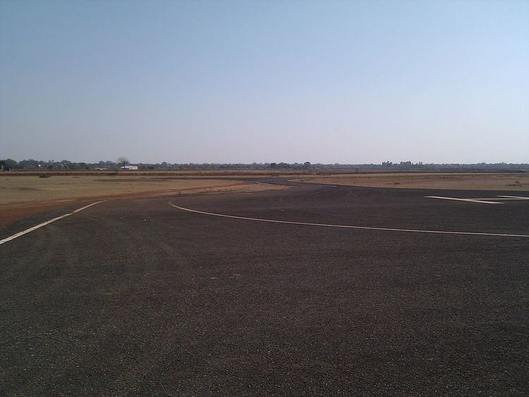
Elevation of the airfield is 276 meters above mean sea level. Runway 17/35 is 1535 meters long and 25 meters wide with turning pads at both ends. A 630 meter long taxiway connects the runway to a small Helipad cum apron.
The runway is small for commercial aircraft like Boeing 737 and Airbus A 320, which need a 2,090 mt. (6,860 ft.) takeoff distance. This means low cost carriers like IndiGo and SpiceJet, which use a single plane type, cannot serve the airport unless the runway is upgraded.