
Population 22,117 (2009) | Area 438.4 km² Local time Thursday 4:19 AM | |
 | ||
Time zone Japan Standard Time (UTC+9) City hall address 2 Chōme 25 Banchi, Aza Higashi 2 Jō Kita, Bihoro-chō, Abashiri-gun, Hokkaidō092-8650 Weather -2°C, Wind S at 6 km/h, 68% Humidity District Abashiri District, Hokkaido | ||
Bihoro (美幌町, Bihoro-chō) is a town located in Abashiri District, Okhotsk Subprefecture, Hokkaido, Japan. The name is derived from the Ainu word piporo, meaning "place of much water".
Contents
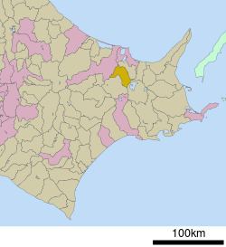
Map of Bihoro, Abashiri District, Hokkaido Prefecture, Japan
Largely agricultural, the town is best known for the Bihoro Pass, which affords scenic views over Lake Kussharo in the Akan National Park.
One of its attractions is Bihoro Aviation Park, which contains a number of aircraft previously used by the Japan Self-Defense Forces.
As of 2009, the town has an estimated population of 22,117 and a population density of 50 persons per km². The total area is 438.36 km².
History
References
Bihoro, Hokkaido Wikipedia(Text) CC BY-SA