
Country United States FIPS code 30-06475 Elevation 1,247 m Population 1,653 (2013) Area code 406 | Time zone Mountain (MST) (UTC-7) GNIS feature ID 0802032 Zip code 59011 Local time Wednesday 10:08 AM | |
 | ||
Weather 1°C, Wind SW at 53 km/h, 40% Humidity Area 246 ha (238 ha Land / 8 ha Water) | ||
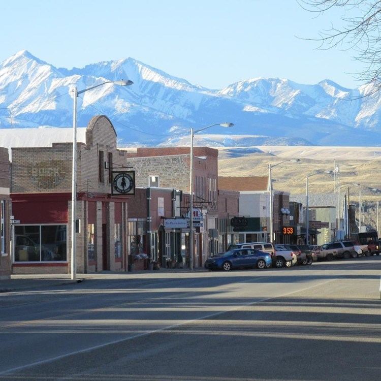
Big Timber is a city in and the county seat of Sweet Grass County, Montana, United States. The population was 1,641 at the 2010 census.
Contents
- Map of Big Timber MT 59011 USA
- Sky on the way to big timber montana
- Geography
- Climate
- 2010 census
- 2000 census
- Notable people
- References
Map of Big Timber, MT 59011, USA
Sky on the way to big timber montana
Geography
Big Timber is located at 45°50′0″N 109°57′1″W (45.833224, -109.950361).
According to the United States Census Bureau, the city has a total area of 0.95 square miles (2.46 km2), of which, 0.92 square miles (2.38 km2) is land and 0.03 square miles (0.08 km2) is water.
Climate
Big Timber has a cool semi-arid climate (Köppen BSk) bordering on a humid continental climate (Dfb). Although winters can be frigid, frequent chinook winds will raise temperatures above 50 °F or 10 °C on an average twenty days between December and February, and have raised them to or above 68 °F or 20 °C on ten occasions during these months since 1894. The chinooks mean Big Timber’s 31.3 days per year failing to top freezing is among the fewest in Montana, with the average window for such maxima being from November 11 to March 18. In the absence of chinooks, temperatures fall to 0 °F or −17.8 °C on seventeen mornings during an average winter, although such temperatures were reached just once in 1999/2000 but as many as thirty-four times during the very cold winters of 1935/1936 and 1978/1979. The average window for zero temperatures is from December 4 to February 25. The coldest temperature in Big Timber has been −47 °F (−43.9 °C) during the notorious 1936 cold wave on February 15, whilst February 1936 was also the coldest month on record at 5.0 °F or −15.0 °C, shading January 1916 which averaged 5.5 °F or −14.7 °C.
Spring is typically windy with temperatures nearly so variable as in winter: the last frost typically arrives on May 19, but temperatures have reached 80 °F or 26.7 °C as early as March 22 of 1928 and have fallen to zero Fahrenheit as late as April 13, 1928 and April 12, 1997. Late in spring thunderstorms increase in frequency and during late spring and early summer these provide most of Big Timber’s annual precipitation. The wettest calendar year since 1894 has been 1957 with 25.71 inches (653.0 mm) and the driest 1939 with 9.38 inches (238.3 mm), whilst the wettest single month has been May 1981 with 7.69 inches (195.3 mm)
During the summer, days can be very hot, with maxima of 90 °F or 32.2 °C on 28.5 afternoons and over 100 °F or 37.8 °C on 1.1, although mornings very rarely stay above 65 °F or 18.3 °C. The record hottest temperature is 110 °F (43.3 °C) on July 21, 1931 and the hottest morning 73 °F (22.8 °C) on July 31 of 1936.
The fall season is usually short and variable, with snow occasionally falling in September, but at other times hot weather can extend into October or even November.
2010 census
As of the census of 2010, there were 1,641 people, 751 households, and 429 families residing in the city. The population density was 1,783.7 inhabitants per square mile (688.7/km2). There were 933 housing units at an average density of 1,014.1 per square mile (391.5/km2). The racial makeup of the city was 95.9% White, 0.1% African American, 0.5% Native American, 0.7% Asian, 0.1% Pacific Islander, 0.5% from other races, and 2.3% from two or more races. Hispanic or Latino of any race were 1.8% of the population.
There were 751 households of which 28.0% had children under the age of 18 living with them, 43.5% were married couples living together, 9.5% had a female householder with no husband present, 4.1% had a male householder with no wife present, and 42.9% were non-families. 38.7% of all households were made up of individuals and 20.9% had someone living alone who was 65 years of age or older. The average household size was 2.13 and the average family size was 2.82.
The median age in the city was 45.5 years. 23.1% of residents were under the age of 18; 5.8% were between the ages of 18 and 24; 20.8% were from 25 to 44; 25.2% were from 45 to 64; and 25.2% were 65 years of age or older. The gender makeup of the city was 48.5% male and 51.5% female.
2000 census
As of the census of 2000, there were 1,650 people, 711 households, and 430 families residing in the city. The population density was 1,752.6 people per square mile (677.7/km²). There were 812 housing units at an average density of 862.5 per square mile (333.5/km²). The racial makeup of the city was 96.61% White, 0.79% Native American, 0.30% Asian, 0.06% Pacific Islander, 0.73% from other races, and 1.52% from two or more races. Hispanic or Latino of any race were 1.70% of the population.
There were 711 households out of which 27.8% had children under the age of 18 living with them, 52.2% were married couples living together, 5.5% had a female householder with no husband present, and 39.5% were non-families. 34.7% of all households were made up of individuals and 19.4% had someone living alone who was 65 years of age or older. The average household size was 2.24 and the average family size was 2.92.
In the city, the population was spread out with 23.7% under the age of 18, 6.6% from 18 to 24, 23.2% from 25 to 44, 23.7% from 45 to 64, and 22.8% who were 65 years of age or older. The median age was 42 years. For every 100 females there were 96.4 males. For every 100 females age 18 and over, there were 91.9 males.
The median income for a household in the city was $30,595, and the median income for a family was $38,869. Males had a median income of $29,000 versus $17,596 for females. The per capita income for the city was $17,569. About 9.3% of families and 10.8% of the population were below the poverty line, including 15.9% of those under age 18 and 7.6% of those age 65 or over.