- land 4.33 sq mi (11 km) - summer (DST) CDT (UTC-5) Population 1,151 (2013) Local time Wednesday 10:14 AM | - water 0.00 sq mi (0 km) Area 11.21 km² Area code 630 Postal code 60511 | |
 | ||
Weather 4°C, Wind W at 37 km/h, 90% Humidity | ||
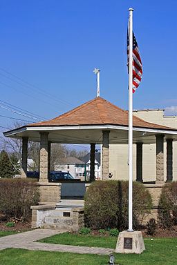
Big Rock is a village in Kane County, Illinois, United States. It is located approximately 50 miles due west of Chicago. It is between the villages of Hinckley and Sugar Grove.
Contents
Map of Big Rock, IL 60511, USA
As of the 2000 census, the village had a total population of 658, although it only became incorporated in July 26, 2001.
Geography
Big Rock is located at 41.759308 N, 88.537617 W.
According to the 2010 census, Big Rock has a total area of 4.33 square miles (11.21 km2), all land.
Education
Big Rock Township is a part of the Hinckley-Big Rock CUSD 429.
References
Big Rock, Illinois Wikipedia(Text) CC BY-SA
