
Local time Monday 7:59 AM | ||
 | ||
Weather 23°C, Wind NE at 3 km/h, 96% Humidity | ||
Betong is a town and administrative district of the Betong Division in Sarawak, Malaysia, lying in the Saribas area. Itused to be placed under the district of Sri Aman.
Contents
- Map of Betong Sarawak Malaysia
- Location
- Population
- Economy
- Education
- Recognition
- Schools and colleges
- References
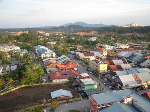
Map of Betong, Sarawak, Malaysia
Location
Betong division is located between three main rivers, Batang Lupar, Batang Saribas and Batang Kelaka, covering an area of 4,180 km2.
Population
By October 2011, the population was nearly 94,000, the majority being Ibans (51,290), followed by Malays (37,283), Chinese (5,084), Bidayuh (225), and Melanau (219), while the remaining are other races.
Economy
Main areas are farming, agriculture and fishing but there are some who work in the public and private sectors as well as business (most businesses are family-owned).
Education
As a way to ensure the development of human capital to meet the demands of Sarawak Corridor of Renewable Energy (SCORE) and other major projects in the State, major investments are made in the development of educational facilities like vocational schools and polytechnics. This is expected to encourage more local and foreign investors to come to Betong and explore opportunities they never knew Betong had.
Recognition
In recognition of Betong’s rich history, rapid growth and contribution to Sarawak's economy, it was accorded Division status in 2002. It was then selected to become the administrative division centre. The areas of administration include the Saratok District and the Betong District. Betong has also been expanded to cover the Small District of Maludam, which had been under the jurisdiction of the Sri Aman District. Betong is acknowledged by many as the place where the earliest educated Ibans can be found. This paved the way for Ibans in other areas to also educate themselves.
Schools and colleges
r