
Country Canada Founded 1786 Time zone AST (UTC-4) Area 46.45 km² Local time Saturday 8:53 PM Area code 506 | Incorporated 1968 Postal code(s) E1W Population 1,137 (2011) | |
 | ||
Weather -13°C, Wind NW at 34 km/h, 67% Humidity | ||
Bertrand (2011 population: 1,137) is a Canadian village in Gloucester County, New Brunswick.
Map of Bertrand, NB, Canada
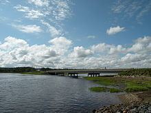
The village is located on the Acadian Peninsula at the mouth of the Caraquet River where it empties into Caraquet Bay, roughly 10 km west of Caraquet. The Community Centres around the Intersection of Route 11 and Route 325.
References
Bertrand, New Brunswick Wikipedia(Text) CC BY-SA