
Highest elevation 53 m (174 ft) Elevation 53 m | Area 0.08 km (0.031 sq mi) Population 0 | |
 | ||
Bergeggi is an island which lies in the Ligurian Sea off the coast near the village of Bergeggi in the Province of Savona, Liguria, Italy.
Contents
Map of Isola di Bergeggi, Italy
Geography
The island is around 8 hectares and its highest point is at 53 m. Punta Predani, a promontory on the mainland, is just a few hundreds metres from the island.
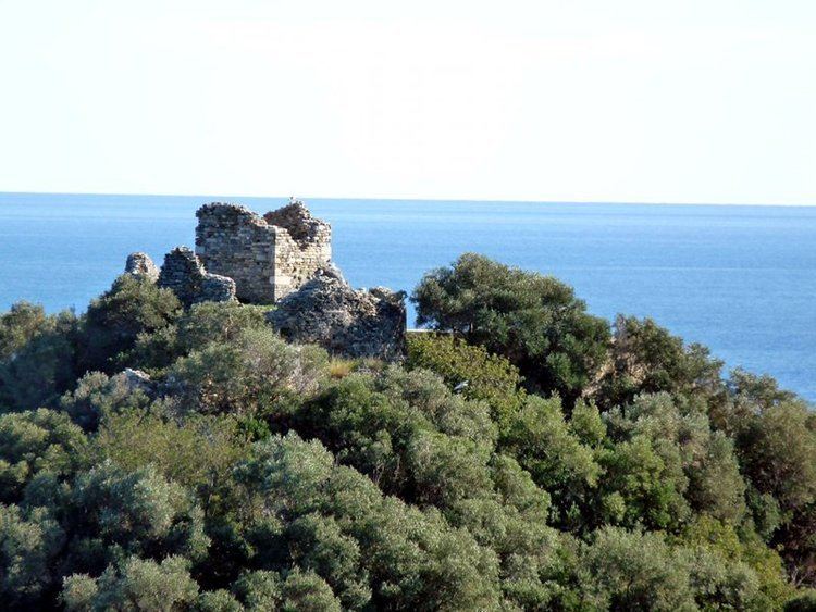
History
The island bears evidences of a proto-historical Ligures' settlement. On its summit stands a watch tower and remains of a 4th-century church devoted to St. Eugenius.
In 992 the bishop of Savona established a monastery on the island, also devoted to the saint, which was later donated to Lérins Abbey's monks. The monastery's ruins are still visible on the island.
Nature conservation
The island with its surrounding marine area is protected as Riserva naturale regionale di Bergeggi, established in 1985 by the Legge Regionale Liguria n. 10 - Istituzione della riserva naturale regionale di Bergeggi. It is also included in a SIC (Site of Community Importance) called Isola Bergeggi - Punta Predani (code IT1323202).
Among many interesting species living in the maquis shrubland covering most of the small island there are Campanula sabatia and Euphorbia dendroides.