
Country United States Elevation 243 m Population 3,358 (2010) | GNIS feature ID 0453106 Area 146.6 km² Local time Friday 7:17 AM | |
 | ||
ZIP codes 46151, 47401, 47408, 47468 Weather -3°C, Wind NW at 13 km/h, 71% Humidity Points of interest Butler Winery and Vineyards, Mason Ridge Camping, Scout Ridge Nature Pr | ||
Benton Township is one of eleven townships in Monroe County, Indiana, United States. As of the 2010 census, its population was 3,358 and it contained 1,716 housing units.
Contents
- Map of Benton Township IN USA
- History
- Geography
- Unincorporated towns
- Cemeteries
- Major highways
- Lakes
- School districts
- Political districts
- References
Map of Benton Township, IN, USA
History
Benton Township was established in 1833. It was named for Thomas Hart Benton, a U.S. Senator from Missouri.
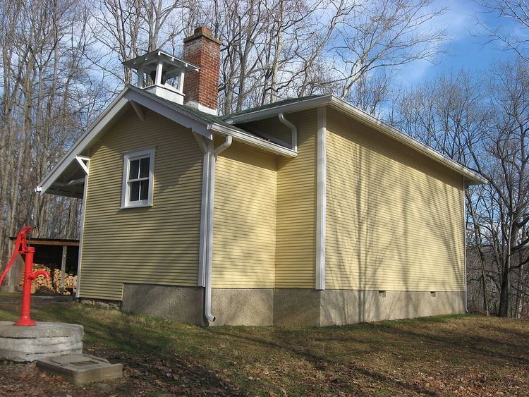
Honey Creek School was listed on the National Register of Historic Places in 1978.
Geography
According to the 2010 census, the township has a total area of 56.61 square miles (146.6 km2), of which 54.92 square miles (142.2 km2) (or 97.01%) is land and 1.69 square miles (4.4 km2) (or 2.99%) is water.
Unincorporated towns
Cemeteries
The township trustee is responsible for four cemeteries: Fleener/Richardson, Stepp, Brock, and Taylor/McGowan/Frye.
Major highways
Lakes
School districts
Political districts
References
Benton Township, Monroe County, Indiana Wikipedia(Text) CC BY-SA