
Country United States FIPS code 31-04020 Elevation 440 m Zip code 68624 Population 424 (2013) | Time zone Central (CST) (UTC-6) GNIS feature ID 0827308 Area 62 ha Local time Thursday 10:41 AM Area code 402 | |
 | ||
Weather 4°C, Wind NW at 23 km/h, 62% Humidity | ||
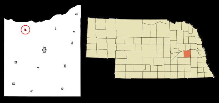
Bellwood is a village in Butler County, Nebraska, United States. The population was 435 at the 2010 census.
Contents
Map of Bellwood, NE 68624, USA
History
Bellwood was laid out in 1890 when the railroad was extended to that point. It was named for its founder, Jesse D. Bell.
Geography
Bellwood is located at 41°20′32″N 97°14′21″W (41.342174, -97.239220).
According to the United States Census Bureau, the village has a total area of 0.24 square miles (0.62 km2), all of it land.
2010 census
As of the census of 2010, there were 435 people, 167 households, and 117 families residing in the village. The population density was 1,812.5 inhabitants per square mile (699.8/km2). There were 187 housing units at an average density of 779.2 per square mile (300.9/km2). The racial makeup of the village was 99.1% White, 0.2% Asian, and 0.7% from two or more races. Hispanic or Latino of any race were 0.7% of the population.
There were 167 households of which 35.3% had children under the age of 18 living with them, 58.1% were married couples living together, 6.0% had a female householder with no husband present, 6.0% had a male householder with no wife present, and 29.9% were non-families. 26.3% of all households were made up of individuals and 13.8% had someone living alone who was 65 years of age or older. The average household size was 2.60 and the average family size was 3.18.
The median age in the village was 37.6 years. 31.7% of residents were under the age of 18; 2.9% were between the ages of 18 and 24; 25.7% were from 25 to 44; 24.4% were from 45 to 64; and 15.4% were 65 years of age or older. The gender makeup of the village was 49.2% male and 50.8% female.
2000 census
As of the census of 2000, there were 446 people, 185 households, and 120 families residing in the village. The population density was 1,871.7 people per square mile (717.5/km²). There were 196 housing units at an average density of 822.6 per square mile (315.3/km²). The racial makeup of the village was 100.00% White. Hispanic or Latino of any race were 0.45% of the population.
There were 185 households out of which 29.2% had children under the age of 18 living with them, 57.8% were married couples living together, 7.0% had a female householder with no husband present, and 35.1% were non-families. 31.9% of all households were made up of individuals and 15.1% had someone living alone who was 65 years of age or older. The average household size was 2.41 and the average family size was 3.11.
In the village, the population was spread out with 26.2% under the age of 18, 9.2% from 18 to 24, 25.6% from 25 to 44, 22.9% from 45 to 64, and 16.1% who were 65 years of age or older. The median age was 36 years. For every 100 females there were 103.7 males. For every 100 females age 18 and over, there were 101.8 males.
As of 2000 the median income for a household in the village was $33,750, and the median income for a family was $39,286. Males had a median income of $28,281 versus $21,125 for females. The per capita income for the village was $14,342. About 1.6% of families and 5.4% of the population were below the poverty line, including 7.3% of those under age 18 and 9.6% of those age 65 or over.