
Population 584 (2011 census) | Postcode(s) 4562 Postal code 4562 | |
 | ||
Location 136 km (85 mi) from Brisbane | ||
Belli Park is a suburb on the Sunshine Coast, Queensland, Australia. The suburb is part of the Sunshine Coast Regional Council local government area.
Contents
Map of Belli Park QLD 4562, Australia
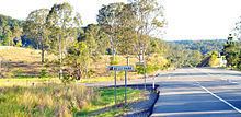
Kenilworth Road is the main thorough fair (and also a popular tourist drive) that connects Belli Park to its nearest townships, being Eumundi (to the east) and Kenilworth (to the west).
Belli Park has a community hall and a Rural Fire Brigade. The Belli Creek and the Belli Park area is a part of the Mary River catchment.
Demographics
In the 2011 census, Belli Park recorded a population of 584 people, 50.9% female and 49.1% male.
The median age of the Belli Park population was 44 years, 7 years above the national median of 37.
74.6% of people living in Belli Park were born in Australia. The other top responses for country of birth were England 7.4%, New Zealand 2.6%, Scotland 1%, Germany 0.9%, Netherlands 0.9%.
90.7% of people spoke only English at home; the next most common languages were 1% German, 0.9% Gilbertese, 0.5% Polish, 0.5% Dutch.