
Country Philippines Founded March 10, 1961 Time zone PST (UTC+8) Local time Thursday 7:06 PM | District Lone district Barangays Area 19.78 km² Province Antique | |
 | ||
Region Western Visayas (Region VI) Weather 27°C, Wind NE at 16 km/h, 71% Humidity | ||
Belison, officially the Municipality of Belison (Karay-a: Banwa kang Belison; Hiligaynon: Banwa sang Belison; Filipino: Bayan ng Belison), is a municipality in the province of Antique in the Western Visayas (Region VI) of the Philippines. The population was 13,539 at the 2015 census. In the 2016 electoral roll, it had 8,564 registered voters.
Contents
- Map of Belison Antique Philippines
- History
- Geography
- Barangays
- Demographics
- Economy
- Municipal seal
- Churches
- References
Map of Belison, Antique, Philippines
Belison is the smallest (in area and population) and the youngest municipality in the province of Antique.
History
Belison was merely a barangay in the larger municipality of Patnongon, adjacent to the north. Belison barangay leaders and Manila-based Belisongnons (Belisong natives) mapped out a petition requesting the national government to make Belison an independent town. The petition was brought to Malacañan Palace on March 10, 1961, and through Presidential Executive Order No. 421 signed by President Carlos P. Garcia, Belison was declared a municipality - the smallest and the youngest in the Province of Antique.
During World War II, Japanese war submarines and other marine craft found the shores of Belison easy entry points to Panay, and invaded the Western Visayas in that location. People still tell of the fear created by these foreign intruders, and also of the bravery of those who decided to resist, creating rebel strongholds in the mountainous areas above the municipality.
When the Japanese air raids would bomb Belison and the nearby communities, families from all around fled to Guinobatan Cave, high in the hills of barangay Buenavista. And when the American forces came, they too used the smooth sea landing in Belison, bringing relief food supplies to Belisongnons, and troops to attack the Japanese occupying forces. They often used local homes in the area to hide in while planning their strategies for assault against the enemy, and enlisted the help of brave men and women to carry out their plans.
Geography
Belison is located at 10°50′N 121°58′E.
According to the Philippine Statistics Authority, the municipality has a land area of 19.78 square kilometres (7.64 sq mi) constituting 6999720000000000000♠0.72% of the 2,729.17-square-kilometre- (1,053.74 sq mi) total area of Antique.
The municipality is bounded on the east by San Remigio, southeast by Sibalom, south by San Jose de Buenavista, north by Patnongon, and west by the Cuyo East Pass.
Barangays
Belison is politically subdivided into 11 barangays, each with a duly constituted government unit known as the barangay council headed by the barangay captain. The Poblacion, seat of the municipal government, is an urban barangay. The other 10 are considered rural.
Demographics
In the 2015 census, Belison had a population of 13,539. The population density was 680 inhabitants per square kilometre (1,800/sq mi).
In the 2016 electoral roll, it had 8,564 registered voters.
Economy
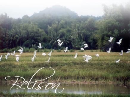
Agriculture continues to be the heartbeat of the town. More than half of its land is riceland, while the rest are planted to corn, coconut, sugar cane and other production like vegetables and peanuts.
Municipal seal
The Belison municipal seal was created to commemorate the agricultural heritage of the town, in order to preserve the legacy of the original settlers in the region. It depicts three mainstay agricultural activities:
Surrounding the great triangle are eleven stars – one representing each barangay in the town. The largest star at the bottom is for the Poblacion. Their strength lies in their connectivity to one another, and in their closeness to the traditions of the past.
Churches
Nine (9) of the leading Christian religious dominations in the Philippines established their presence in the town. Most Belisongnons (people of Belison) are of Aglipayan ancestry.