
Country Canada Rural Municipality St. Louis No. 431 Incorporated (village) 1885 Local time Monday 1:47 PM | Census division 17 Established 1872 Area code 306 | |
 | ||
Region Southcentral Saskatchewan Weather -11°C, Wind SW at 23 km/h, 49% Humidity | ||
Batoche, Saskatchewan was the site of the historic Battle of Batoche during the Northwest Rebellion of 1885. The battle resulted in the defeat of Louis Riel and his Métis forces by Major General Frederick Middleton and his Northwest Field Force.
Contents
Map of Batoche, SK, Canada
History
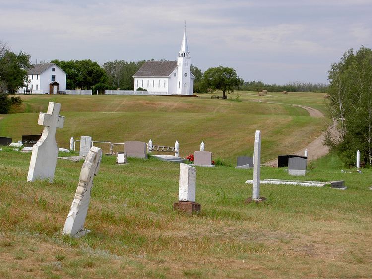
The Métis settlement of Batoche (named after Xavier Letendre dit Batoche) was established in 1872. By 1885 it numbered 500 people. The Métis of the area settled on river lots, and the community contained several stores as well as the Roman Catholic Church of St. Antoine de Padoue at the time of the Rebellion. Batoche was the de facto capital of Riel's Provisional Government of Saskatchewan.
Batoche is a Southbranch Settlement. It is situated mainly along the east bank of the South Saskatchewan River between St. Laurent and Fish Creek. This area is part of the aspen parkland biome.
This community consisted mostly of Francophones and Roman Catholics.
Batoche National Historic Site
Batoche was declared a National Historic Site of Canada in 1923. The visitor centre features a multimedia presentation about the history of the community and its inhabitants. There are several restored buildings with costumed interpreters who depict the lifestyles of the Métis of Batoche between 1860 and 1900. The sites include a NWMP encampment, a church and rectory complex, and a farm home. The sites are set at different locations around the community. The complex is open from mid-May through mid-September.