
Region AzadKashmir Time zone PST (UTC+5) | ||
 | ||
Barali is a village and union council, located between Kotli and Gulpur in Kotli District, Azad Kashmir. It's a small town with vast fields and good views, placed on a valley.
Contents
Map of Barali
History
Barali is a beautiful village and union council located between Kotli and Gulpur. It is located in a very beautiful valley with vast fields and outstanding views.
Poverty
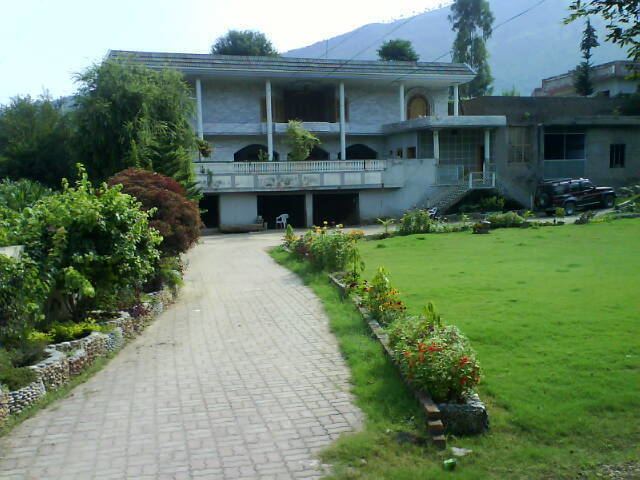
There is a gap between rich and poor in the village families with relatives abroad obtain more money and have bigger houses being built, the majority of people though earn a living as farmers. Although, most people in Barali are poor, some do own their own land. The rich families in this area mostly belong to the Mangral Rajput clan and the Chaudhry Jatt Clan. Many of them have relatives abroad, mostly in England, who send money. Recently development start to happen with a new telephone exchange and fiber optic phone and broad band connection to villagers.
Adajacent villages of Barali are Kass, Fafeel, Seri Dhar, Mankal and Mansooh. These area got tremendous potential of tourism.
Roads
In recent years there has been a new road built that connects Kotli and Gulpur through Barali. Matters of law are usually settled out of court, with an older, respected person acting as a mediator.