
Population 1,122 (2011 census) Time zone AEST (UTC+10) Elevation 35 m | Postcode(s) 2300 Area 50 ha Postal code 2300 | |
 | ||
Location 1.6 km (1 mi) SSW of Newcastle | ||
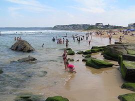
Bar Beach is an inner city suburb of Newcastle, New South Wales, Australia, located 1.6 km (1.0 mi) southwest of Newcastle's central business district. The suburb is named for the beach that extends along its eastern border. At the 2011 census, Bar Beach had a population of 1,122.
Contents
Map of Bar Beach NSW 2300, Australia
The beach is home to the Cooks Hill Surf Life Saving Club.
History
The Australian Agricultural Company held extensive Crown land grants in the Newcastle area that have since been developed into the modern day suburbs of Bar Beach, Cooks Hill, Hamilton and Broadmeadow as well as parts of the Newcastle Central Business District and The Hill. The Company released lots for residential development in Bar Beach in 1924.
A natural rock pool at the beach was named "The Bar" and Bar Beach took its name from that feature.
Shipwrecks
The northern part of the beach is commonly known as Susan Gilmore Beach, named after the American clipper Susan Gilmore that was wrecked there in the early hours of 4 July 1884. Nearby the City of Newcastle (on 12 September 1878) and USS WST-1 (on 27 July 1945) were also wrecked.
Heritage
The suburb has a number of local landmarks which have been heritage listed including the Cooks Hill Surf Life Saving Club and Memorial, Reid Park Tennis Clubhouse and Tennis Courts and the Empire Park Bowling Club Fence. A number of residential units in the Art Deco style have also attracted heritage listing.