
Country Brunei Mean solar time UTC+07:39:00 Area 10 km² Population 3,970 (2008) | Time zone (UTC+8) Website municipal-bsb.gov.bn Local time Thursday 3:45 AM | |
 | ||
Weather 26°C, Wind NE at 16 km/h, 92% Humidity | ||
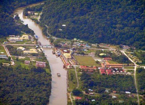
Bangar is a small town in Brunei, and the capital of Temburong District, an isolated territorial exclave separated from the rest of Brunei by the Sarawak State of Malaysia.
Contents
Map of Bangar, Brunei
Geography
The town is in the Mukim Bangar (sub-district) of Temburong District. The population is 3,970 inhabitants.
One main road runs through the town, roughly east-west. Headed east of Bangar is Lawas, Sarawak (Malaysia) and to the west is the river crossing to Limbang, Sarawak (Malaysia). The road is the major route to the local quarry where boulders are collected, processed and shipped to stockyards in the capital, Bandar Seri Begawan, for construction companies.
References
Bangar, Brunei Wikipedia(Text) CC BY-SA