
Province Province of Las Palmas | ||
 | ||
Similar Roque Nublo, Pico de las Nieves, Roque Bentayga, Teide, Roque de los Muchachos | ||
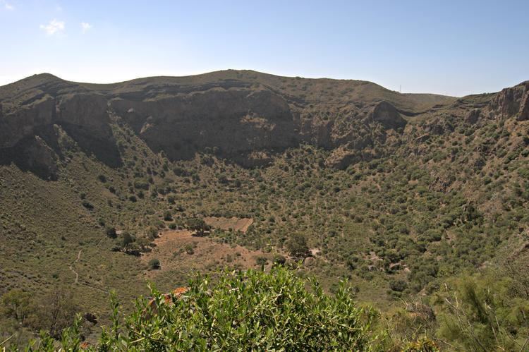
The Bandama Natural Monument is part of the Tafira Protected Landscape on the island of Gran Canaria in the Canary Islands, Spain. It's considered a point of geological interest, because of the Caldera de Bandama. This volcanic crater, which is geologically a maar rather than a caldera, reaches 569 m (1,867 ft) above sea level at the highest point on its rim, Pico de Bandama, and is about 1,000 m (3,300 ft) wide and 200 m (700 ft) deep.
Map of Caldera de Bandama, Las Palmas, Spain
The bottom of the caldera contains volcanic ash of different colours, and some botanic species of Canary Islands origin.
The Caldera de Bandama is located at the meeting point of three municipalities: Las Palmas de Gran Canaria, Santa Brígida and Telde.
References
Bandama Caldera Wikipedia(Text) CC BY-SA