
Country Brazil State São Paulo Time zone UTC-3 (UTC-3) Elevation 454 m Local time Wednesday 12:16 PM | Region Southeast Settled July 10, 1783 Area 616.4 km² Population 10,775 (2015) | |
 | ||
Metropolitan Region Vale do Paraíba e Litoral Norte Weather 31°C, Wind NW at 16 km/h, 50% Humidity | ||
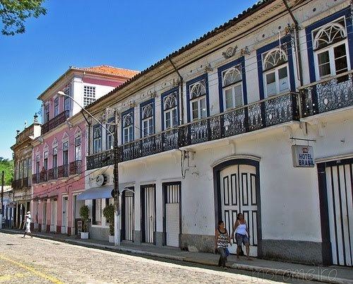
Bananal is a city in the state of São Paulo in Brazil. It is part of the Metropolitan Region of Vale do Paraíba e Litoral Norte. The population is 10,775 (2015 est.) in an area of 616.43 km².
Map of Bananal, State of S%C3%A3o Paulo, Brazil
It borders three cities of Rio de Janeiro state (Barra Mansa to the north, Rio Claro to the east and Angra dos Reis to the south), as well as São José do Barreiro and Arapeí (both in São Paulo) to the west. It is the easternmost municipality in Sâo Paulo state.
It features a historical railway station imported from Belgium in 1888.
The municipality contains part of the 292,000 hectares (720,000 acres) Mananciais do Rio Paraíba do Sul Environmental Protection Area, created in 1982 to protect the sources of the Paraíba do Sul river. It also contains the 884 hectares (2,180 acres) Bananal Ecological Station, created in 1987.