
Founded 1379 Elevation 4,652 ft (1,418 m) Area 131 km² Province West Region | Created 1963 Time zone Africa/Douala (UTC1) Population 5,727 (2012) Local time Wednesday 3:48 PM | |
 | ||
Weather 28°C, Wind S at 8 km/h, 35% Humidity | ||
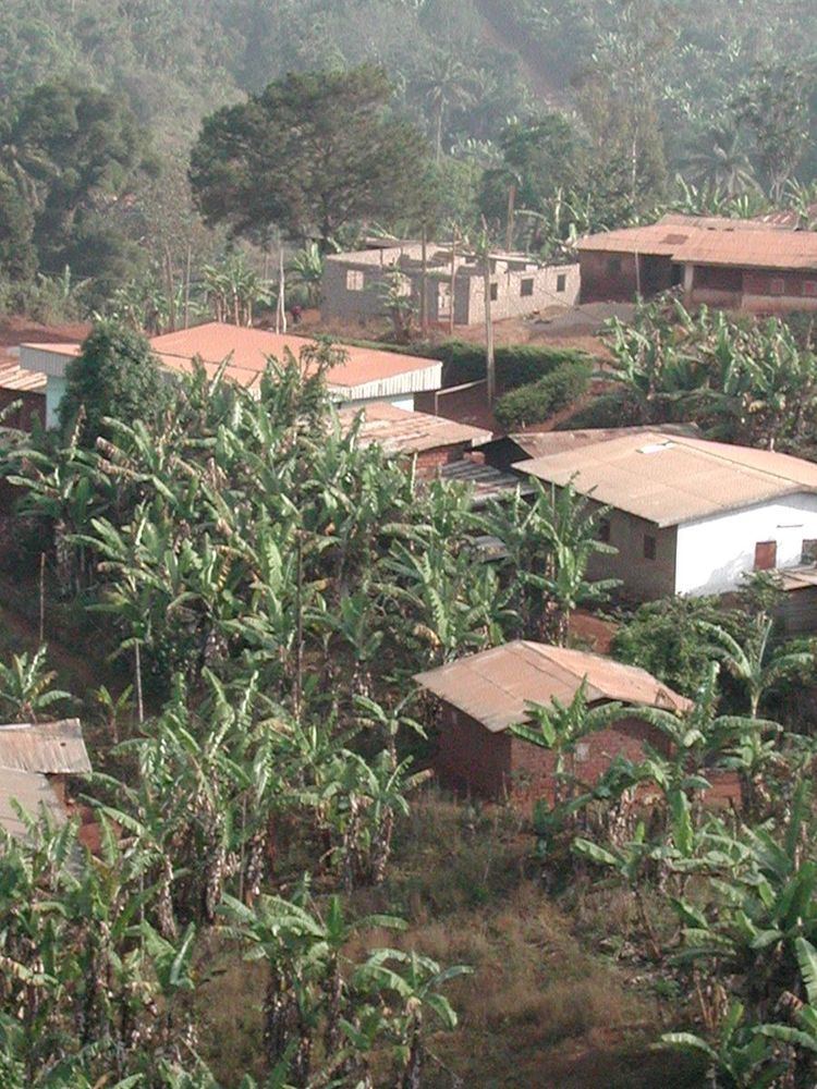
Bana is a sub-prefecture and commune in the West Province of Cameroon, some 8 km east of Bafang and 2 km south-west of Babouantou.
Contents
- Map of Bana Cameroon
- Geography
- Geology
- Hydrography
- Districts
- Batcha
- Badoumkassa
- Bakassa
- History
- Economy
- References
Map of Bana, Cameroon
Geography
Bana is accessed by road P15 which comes from Barmena in the east which passes through the heart of the commune and continues west to join the N5 road in the north-east of Bafang.
The word Bana means "birth place" (Ba = place, Na = born). The inhabitants are called Née however they often call themselves bana in French. Née signifies insistence, harassment, pursuit which may reflect the qualities of the founder of the town.
The language spoken in the commune is Fe'fe' which the locals simply call Bana.
The commune is located at a high altitude of 1,418 metres and consequently has a cool climate.
Geology
The land is of volcanic origin with basaltic bedrock (25%), granite (45%), and gneiss (18%). The soil is fertile. The wooded landscape is the result of a long interaction between the people and the land.
Hydrography
The rivers which cross the territory of the commune are:
Districts
The commune four districts:
Batcha
Batcha is a village located on one of the old Bafang-Bangangté roads in the east of Bana. Local people and some Mbororo (Fulani) nomadic herders live here attracted large pastures on the steep slopes of the mountain range that runs from Bana to Batcha and beyond.
The community feature a large natural area sheltered by hills and mountains and especially by Mount Banatcha near Bana (according to sources) which rises to 2097 m.
Batcha in bamiléké means "land" or "visit".
Badoumkassa
Bandoumkassa is a village at an altitude of about 1500 metres. The temperature here can easily be 11° C at certain times of the year. The people live mainly from agriculture and small business. Here there are both opulent villas and brick huts. This district has been led for the past thirty years by His Majesty Victor Kamaha II who was a senior officer in the Cameroon police.
Bakassa
Bakassa is a village in the south of Bana. This is one of the largest villages by both population and area in the Bana arrondissement. This mountain village lies between other riverbank villages: Bana, Banfeko, Badoumkassa, Bassap, Bapoutcheu Ngaleu etc. It can be reached by road via all these villages.
Agriculture is the main activity including food crops and coffee. This village has a particularly cool climate because of the altitude. This is one of the oldest chiefdoms in the district headed by His Majesty F. Ngako for many years since. He is the doyen of age and longevity of his reign for the arrondissement of Bana and the department of Haut-Nkam.
History
Bana was once a customary kingdom founded in 1379 by Fon Tchokogwe(Nza), a first-degree chefferie (chiefdom) led by Fon Sikam Happi V. His successor in 2003 was Konchipe Happi IV.
The first chefferies in this part of bamiléké country were founded in the 17th century on the heights of the Ndumla plateau. The founders of these chefferies followed in the path of Neolithic people who also settled the area as evidenced by the results of the archaeological mission by F. Paris in 1974 with the discovery of stone tools on the same heights.
The chefferie is in the No. Ndum district: Ndum means "over" or "above" while Ndak means "Low", The lowlands are traditionally reserved for the elite.
From 1916 to 1920 Bana was the capital of the Western Division under French administration.
Economy
The main economic activities are agricultural with the production of coffee and other vegetables.