
Country Ireland Eircode (Routing Key) A41 Elevation 35 m | Irish Grid Reference O149535 Local time Wednesday 2:34 AM | |
 | ||
Weather 4°C, Wind SW at 13 km/h, 86% Humidity | ||
Ballyboughal (Irish: Baile Bachaille) is a town in North Dublin near the Naul. The name means the town of the staff, and the Bachal Isu was protected in this area until Strongbow moved it to Christ Church, Dublin. It is also near Oldtown.
Map of Ballyboughal, Co. Dublin, Ireland
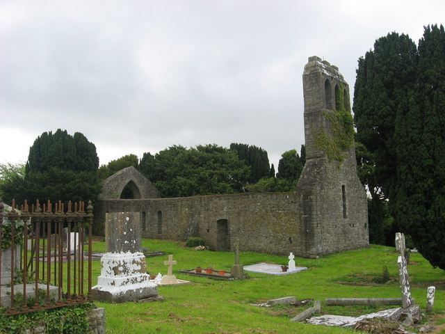
In addition to the Church of the Assumption, erected in 1836, the medieval church still stands in ruins in the Old Ballyboughal Burial Ground north of the center of the town. It is the place where the Bachal Isu was kept. All the walls stand without the roof, and the building, which has some grave markers on the inside, is divided into a nave and chancel with doors on the north and south sides. The west gable has a triple bellcote, and the east gable has an arched window (without glass) dating from the fourteenth century.
There was a monastery in Ballyboughal sometime before the arrival of the Anglo-Normans.
The Ballyboughal (or Ballyboghil) River flows eastward through the center of the town. It has its source at Tobergregan, south of Garristown, and its mouth at the Rogerstown Estuary.