
 | ||
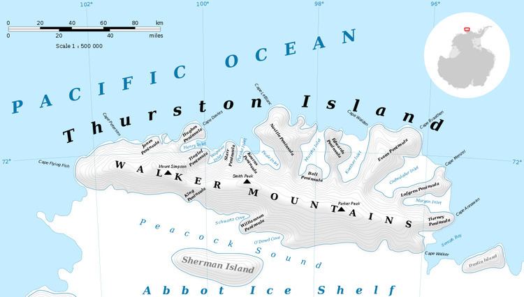
Ball Peninsula (72°8′S 98°3′W) is a broad ice-covered peninsula on the north side of Thurston Island, Antarctica. It extends into Murphy Inlet between Noville Peninsula and Edwards Peninsula. It was named by the Advisory Committee on Antarctic Names after Lieutenant (jg) James L. Ball, PBM Mariner pilot in the Eastern Group of U.S. Navy Operation Highjump, which obtained aerial photographs of this peninsula and adjacent coastal areas, 1946–47. Ball commanded the January 11, 1947 search plane which, after 12 days of uncertainty, found the burned wreck and survivors of the Mariner crash on Noville Peninsula.
Maps
References
Ball Peninsula Wikipedia(Text) CC BY-SA